
Prominence 1,560 m | Elevation 5,230 m First ascent 1889 First ascender James de Salis | |
 | ||
Mountain range Trans-Mexican Volcanic Belt Similar Popocatépetl, Pico de Orizaba, Malinche, Nevado de Toluca, Parícutin | ||
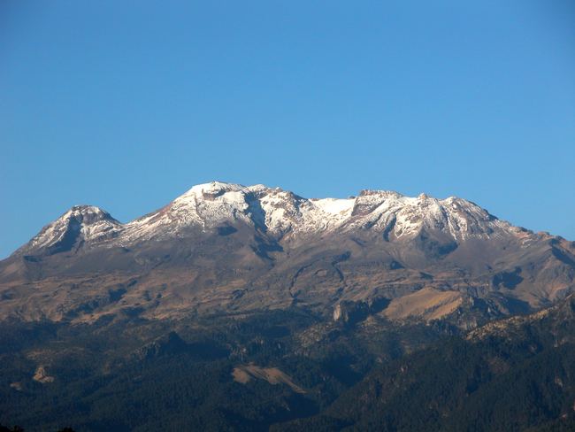
Iztaccíhuatl (alternative spellings include Ixtaccíhuatl, or either variant spelled without the accent) ([istakˈsiwatɬ] or, as spelled with the x, [iʃtakˈsiwatɬ]), is a 5,230 m (17,160 ft) dormant volcanic mountain in Mexico located on the border between the State of Mexico and Puebla. It is the nation's third highest, after Pico de Orizaba 5,636 m (18,491 ft) and Popocatépetl 5,426 m (17,802 ft).
Contents
- Map of Iztaccihuatl Puebla Mexico
- Aventurate ascensi n al iztacc huatl en m xico
- GeologyEdit
- Legend of Popocatpetl and IztacchuatlEdit
- ElevationEdit
- References
Map of Iztaccihuatl, Puebla, Mexico
The name "Iztaccíhuatl" is Nahuatl for "White woman", reflecting the four individual snow-capped peaks which depict the head, chest, knees and feet of a sleeping female when seen from east or west.
Iztaccíhuatl lies to the north of Popocatépetl, to which it is connected by the high altitude Paso de Cortés. Depending on atmospheric conditions the dormant volcano is visible much of the year from Mexico City some 70 km (43 mi) to the northwest.
The first recorded ascent was made in 1889, though archaeological evidence suggests the Aztecs and previous cultures climbed it previously. It is the lowest peak containing permanent snow and glaciers in Mexico.
Aventurate ascensi n al iztacc huatl en m xico
GeologyEdit
The summit ridge of the massive 450 km3 (110 cu mi) volcano is a series of overlapping cones constructed along a NNW-SSE line to the south of the Pleistocene Llano Grande caldera. Andesitic and dacitic Pleistocene and Holocene volcanism has taken place from vents at or near the summit. Areas near the El Pecho summit vent are covered in flows and tuff beds post-dating glaciation approximately 11 ka (thousand years ago). The most recent vents are located at El Pecho and a depression at 5,100 m (16,700 ft) along the summit ridge midway between that summit and Los Pies.
Legend of Popocatépetl and IztaccíhuatlEdit
In Aztec mythology, Iztaccíhuatl was a princess who fell in love with one of her father's warriors, Popocatépetl. The emperor sent Popocatépetl to war in Oaxaca, promising him Iztaccíhuatl as his wife when he returned (which Iztaccíhuatl's father presumed he would not). Iztaccíhuatl was falsely told Popocatépetl had died in battle, and believing the news, she died of grief. When Popocatépetl returned to find his love dead, he took her body to a spot outside Tenochtitlan and kneeled by her grave. The gods covered them with snow and changed them into mountains. Iztaccíhuatl's mountain is called "White Woman" (from the nahuatl iztac "white" and cihuatl "woman") because it resembles a woman lying on her back, and is often covered with snow. (The peak is sometimes nicknamed La Mujer Dormida ("The Sleeping Woman".) Popocatépetl became an active volcano, raining fire on Earth in blind rage at the loss of his beloved.
ElevationEdit
Iztaccihuatl is usually listed at 5,286 m (17,343 ft). SRTM data and the Mexican national mapping survey assert that a range of 5,220 to 5,230 m (17,130 to 17,160 ft) is more accurate. The Global Volcanism Program cites 5,230 m (17,160 ft).