
Native name 石徹白川 | Mouth Kuzuryū River | |
 | ||
Main source Mount Chōshi1,810 m (5,940 ft) | ||
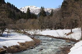
The Itoshiro River (石徹白川, Itoshiro-gawa) is a river through Gifu and Fukui prefectures in Japan.
Contents
Map of Itoshiro River, Ono, Fukui Prefecture, Japan
Geography
The Ishitoro River flows from Mount Chōshi (銚子ヶ峰 Chōshi-ga-mine) on the borders of Gujō and Takayama in Gifu Prefecture and flows south before emptying into the Kuzuryū River near Ōno in Fukui Prefecture.
There are two majors damns along the river, both in Ōno: the Itoshiro Dam (石徹白ダム Itoshiro Damu) and the Yanbara Dam (山原ダム Yanbara Damu).
References
Itoshiro River Wikipedia(Text) CC BY-SA