
Population 1,530 (2006 census) Postcode(s) 2296 Postal code 2296 | Established 1870s Area 71 ha | |
 | ||
Location 156 km (97 mi) NNE of Sydney3.4 km (2 mi) W of Newcastle | ||
Islington /ˈɪzlɪŋtən/ is a suburb of the city of Newcastle in the Hunter Region of New South Wales, Australia. Located only 3.4 kilometres (2.1 mi) from the Newcastle CBD on one of Newcastle's major arterial roads, it was initially developed as a residential suburb. Today it includes a small industrial area and is adjacent to the Newcastle campus of the Hunter Institute of Technology. Its southeastern border is occupied entirely by the Hunter and Newcastle and Central Coast railway lines. The suburb has one railway station, which is shared with, and named after, adjacent Hamilton.
Contents
Map of Islington NSW 2296, Australia
History
Islington was developed in the 1870s as a residential suburb. It is located on Maitland Road, which later became part of the Pacific Highway and was part of Highway 1 until the Minmi to Beresfield section of the Sydney-Newcastle Freeway was completed in 1998. The convenient location attracted small factories.
The Regent Theatre in Islington, located on the corner of Maitland Road and Beaumont Street, opened on 2 December 1928. In 1941 or 1942, Hoyts Theatres obtained a majority interest in the property but, with the advent of television, the Regent was unable to survive and closed on 27 June 1964. After remaining empty for five years, the building reopened as a hardware store in August 1969 and operates in that capacity today.
In 1947, Lettesi (a settler group made up of nearly 150 families from the village of Lettopalena in the Abruzzo region of Italy) settled in the Islington region, primarily due to its proximity to the BHP steel works.
Present day
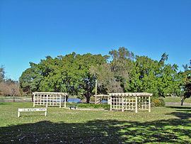
Islington Park, located on Throsby Creek, has a cycleway that links Islington to the redeveloped Newcastle foreshore. Islington is located at the north-eastern end of Beaumont Street, the restaurant precinct of Newcastle. Known as the antique district of Newcastle, with numerous shops primarily located on Maitland Road, which also houses Islington's main trade area, with more shops on Beaumont Street. Located on Maitland Road is the Gateway Hotel which is a gay pub.
Islington had a problem with street sex work. A residents group was formed to work with authorities to eradicate the practice although complaints continue.
Transport
Maitland Road, a suburban carrier of the Pacific Highway, runs through the suburb and links it to Mayfield and Newcastle West.
Islington is served by bus services operated by Newcastle Buses & Ferries, including routes 100, 101, 103 and 108 along Maitland Road, and route 111 through the suburb's east. In addition, the Hamilton railway station, located on the Newcastle and Central Coast and Hunter Lines, is located on the suburb's southern boundary and provides regular services to Maitland, the Central Coast and Sydney.