
Time zone EET (UTC+2) Vehicle registration Z Area 4.652 km² Area code 210 | Elevation 150 m (490 ft) Postal code 144 xx Website www.iraklio.gr Local time Wednesday 9:02 AM | |
 | ||
Weather 12°C, Wind NE at 10 km/h, 71% Humidity | ||
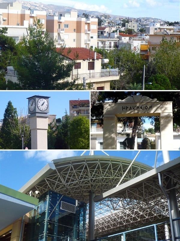
Iraklio (Greek: Ηράκλειο) is a suburb in the northeastern part of the Athens agglomeration, Greece, and a municipality of the Attica region.
Contents
Map of Irakleio, Greece
Geography
Iraklio is located about 8 km northeast of Athens city centre. The municipality has an area of 4.638 km2. Its built-up area is continuous with those of the neighbouring suburbs Nea Ionia, Metamorfosi, Lykovrysi and Pefki. Irakleio is subdivided into several quarters, including Palaio Irakleio, Neo Irakleio, Ano Irakleio and Prasinos Lofos. The main thoroughfare is Irakliou Avenue, which connects it with central Athens. The northern beltway of Athens, Motorway 6, passes through Irakleio. Irakleio is served by a subway station (Iraklio station) and by a commuter railway station (Iraklio railway station).
History
Iraklio was named after a sanctuary of Heracles that was located in the area in classical antiquity. Before the Greek War of Independence the village was known as Arakli. Iraklio was part of the city of Athens until 1925, when it became a separate community, elevated to municipality in 1948. The earthquake of September 7, 1999, affected the area but caused minor damages.