Ipswich is the innermost suburb of Ipswich, Queensland, Australia. The suburb situated on the Bremer River. At the 2011 Australian Census the suburb recorded a population of 2,356.
The suburb of Ipswich has a number of distinct areas. The Ipswich central business district is in the north with the Bremer River forming the northern boundary. Limestone Hill and its parklands are to the east (27°37′01″S 152°46′09″E). Denmark Hill with its exclusive residential area and conservation park is to the west (27°37′09″S 152°45′14″E). A mixture of health, educations and residential areas make up the south.
The Ipswich CBD is centred on Brisbane and Limestone Streets, and the Ipswich Mall, and includes major supermarkets and chain stores, specialties stores and the many government agencies. Most street parking is controlled by parking meters in business hours.
Ipswich has a number of heritage-listed sites, including:
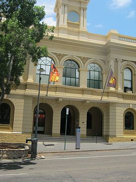
5 Brisbane Street: Queensland Country Women's Association Girls' Hostel25 Brisbane Street: Ulster Hotel89 Brisbane Street: Queensland National Bank93 Brisbane Street: William Johnston's Shops116 Brisbane Street: Old Ipswich Town Hall116A Brisbane Street: former Bank of Australasia124 Brisbane Street: St Pauls Anglican Church169-175 Brisbane Street: Bostock Chambers188 Brisbane Street: Baptist Church231 Brisbane Street: Flour Mill253 Brisbane Street: Hotel Metropole68 Chermside Road: St Michaels Nursing Home82 Chermside Road: Ipswich Girls' Grammar School Buildings82 Chermside Road: Lime Kiln Remains48 d'Arcy Doyle Place (formerly Nicholas Street): St Paul's Young Men's ClubEllenborough Street: Ipswich Central MissionEllenborough Street: Railway Signal Cabin and Turntable45 East Street: Ipswich & West Moreton Building Society building59 East Street: Old Ipswich Courthouse86 East Street: Uniting Church Central Memorial Hall1 Ginn Street: Ginn Cottage14 Gray Street: Ipswich Club HouseLimestone Street: Liberty Hall22 Limestone Street: St Stephen's Church88 Limestone Street: Ipswich Technical College103 Limestone Street: Penrhyn109 Limestone Street: Colthup's House7 Macalister Street: To-Me-ReeMary Street: St Marys Roman Catholic ChurchMilford Street: Queens Park1A Milford Street: Claremont10A Milford Street: Walter Burley Griffin Incinerator11 Murphy Street: Brickstone63 Nicholas Street: Soldiers' Memorial Hall3 Parker Avenue: Ipswich Mental Hospital (Challinor Centre)21 Quarry Street: Central Congregational Church Manse30 Quarry Street: Toronto (formerly known as Devonshire Cottage)43 Quarry Street: GooloowanRockton Street: Rockton20 Roderick Street: Keiraville66 Roderick Street: Ozanam HouseWoodend Road: Ipswich Grammar School BuildingsThere are three forms of public train transport servicing the Ipswich region.
Queensland Rail City network offers regular services to and from Ipswich railway station to Brisbane, Brisbane Airport, the eastern suburbs, and western suburbs (as far as Rosewood).Westside Buslines is the prominent bus company in Ipswich, linking all sides of town to Ipswich CBD; Redbank; Springfield; or Forest Lake (in Brisbane).Southern Cross Citilink is a bus which operates between Ipswich and Indooroopilly via Riverlink, Karalee, Chuwar, Karana Downs, Anstead, and Kenmore.Queensland Rail buses offer direct daily services to Gatton, Helidon, Fernvale, Lowood, Coominya, Esk, and Toogoolawah.An Airport Express Bus operates from Ipswich to Brisbane Airport on a regular basis. Bookings are essential.Ipswich also has direct access to the Ipswich Motorway (linking to Brisbane); the Cunningham Highway (linking to Warwick); the Warrego Highway (linking to Toowoomba); and the Centenary Highway (linking Springfield and the Ripley Valley to Brisbane).
The Westlander train pasts through Ipswich Station once a week to Toowoomba and Charleville.Greyhound Australia (coaches) offer daily direct services to Toowoomba, Mount Isa, Charleville and Sydney from the Ipswich Transit Centre.Crisps Coaches offer daily direct services to and from Warwick, Queensland and Stanthorpe.University of Southern Queensland, Ipswich Campus, formerly the Ipswich Campus of the University of Queensland and the Ipswich Mental Hospital (Challinor Centre)Ipswich Girls' Grammar School, established 1892Ipswich Central PrimaryIpswich Special SchoolIpswich Hospital Chelmsford AvenueSt Andrews Private Hospital, Roderick StreetMany GPs and specialists can be found in Brisbane and Limestone Street, and near both hospitals.
Parks and sports facilities
Queens ParkLimestone Park (AFL, running track, velodrome, netball)Sandy Gallop Golf CourseBMX trackDenmark Hill Conservation ParkIpswich Show Ground (including indoor sports centre)St Mary's Catholic Church, Elizabeth StreetSt Paul's Anglican Church, Brisbane StreetCalvary Baptist Church, Chermside StreetUniting Church, Ellenborough StreetChurch of Jesus Christ of Latter Day Saints, cnr Hunter and Haig StreetsThe Salvation Army, South StreetJehovah's Witnesses, Salisbury StreetSt John's Lutheran Church, Roderick StreetCentro Church, Pring StreetIn the 2011 Census the population of Ipswich is 2,536, 51.6% female and 48.4% male. The median/average age of the Ipswich population is 37 years of age. 76.5% of people living in Ipswich were born in Australia. The other top responses for country of birth were New Zealand 3.7%, England 3.4%, India 0.9%, Papua New Guinea 0.6%, Malaysia 0.6%. 85.3% of people speak English as their first language 0.7% Cantonese, 0.6% Kirundi (Rundi), 0.6% Malayalam, 0.5% German, 0.4% Mandarin.