
Length 38.62 km | Constructed 1 January 1969 | |
 | ||
Existed: January 1, 1969 (1969-01-01) – present | ||
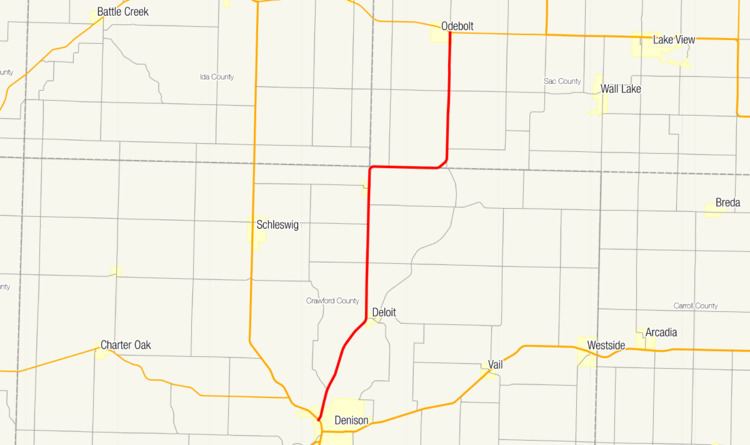
Iowa Highway 39 (Iowa 39) is a north–south state highway in western Iowa. It begins at an intersection with U.S. Route 59 and Iowa Highway 141 on the western edge of Denison. The route ends at its intersection with Iowa Highway 175 on the eastern side of Odebolt.
Contents
Map of IA-39, Iowa, USA
Route description
Iowa 39 begins on the west side of Denison, Iowa at an intersection with U.S. Route 59 and Iowa Highway 141. Heading north-northwest, it runs parallel to the Boyer River between Denison and Deloit. At Deloit, the route straightens northward and travels 7 miles (11 km) to Kiron. North of Kiron, it turns east for 4 miles (6.4 km) before turning back to the north for 7 miles (11 km). The route ends at Iowa Highway 175 in Odebolt.
History
Prior to 1969, the route that is now designated as Iowa 39 was designated as Iowa Highway 4. This version of Iowa 4 once connected Hamburg and Spirit Lake along the current routings of U.S. Route 275, U.S. Route 59, and U.S. Route 71. In 1969, when many routes were renumbered, Iowa 4 was redesignated as Iowa Highway 39.