
Population 16,075 (2011 census) Website Inverell Shire Area 8,606 km² Council seat Inverell | Inverell Shire Glen Innes Severn Region North West Slopes | |
 | ||
Mayor Paul Harmon (Unaligned) Points of interest Inverell Pioneer Village, National Transport Museum, Kwiambal National Park | ||
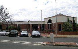
Inverell Shire is a local government area in the North West Slopes region of New South Wales, Australia adjacent to the Macintyre River and the Gwydir Highway.
Contents
- Map of Inverell NSW Australia
- Main towns and villages
- Demographics
- Current composition and election method
- References
Map of Inverell, NSW, Australia
The Mayor of Inverell Shire Council is Cr. Paul Harmon, who is unaligned with any political party.
Main towns and villages
The shire includes the town of Inverell and small towns and villages including Gilgai, Stannifer, Elsmore, Bukkulla, Ashford, Bonshaw, Yetman, Wallangra, Graman, Oakwood, Delungra and Mount Russell.
Demographics
At the 2011 census, there were 16,075 people in the Inverell local government area, of these 49.1 per cent were male and 50.9 per cent were female. Aboriginal and Torres Strait Islander people made up 6.5 per cent of the population which is approximately two-and-a-half times above both the national and state averages of 2.5 per cent. The median age of people in the Inverell Shire was 41 years; slightly higher than the national median of 37 years. Children aged 0 – 14 years made up 21.3 per cent of the population and people aged 65 years and over made up 19.2 per cent of the population. Of people in the area aged 15 years and over, 51.3 per cent were married and 11.8 per cent were either divorced or separated.
Between the 2001 census and the 2011 census the Inverell Shire experienced nominal population growth in both absolute and real terms. When compared with total population growth of Australia for the same periods, being 5.78 per cent and 8.32 per cent respectively, population growth in the Inverell local government area was significantly lower than the national average. The median weekly income for residents within the Inverell Shire was significantly below the national average.
At the 2011 census, the proportion of residents in the Inverell local government area who stated their ancestry as Australian or Anglo-Saxon exceeded 88 per cent of all residents (national average was 65.2 per cent). In excess of 68 per cent of all residents in the Inverell Shire nominated a religious affiliation with Christianity at the 2011 census, which was higher than the national average of 50.2 per cent. Meanwhile, as at the census date, compared to the national average, households in the Inverell local government area had a significantly lower than average proportion (3.2 per cent) where two or more languages are spoken (national average was 20.4 per cent); and a significantly higher proportion (94.5 per cent) where English only was spoken at home (national average was 76.8 per cent).
Current composition and election method
Inverell Shire Council is composed of nine councillors elected proportionally as a single ward. All councillors are elected for a fixed four-year term of office. The mayor is elected by the councillors at the first meeting of the Council. The most recent election was held on 10 September 2016, and the makeup of the Council is as follows:
The current Council, elected in 2012, in order of election, is: