
Population 289 (2006 census) Postal code 2360 | Postcode(s) 2360 Local time Tuesday 10:43 AM | |
 | ||
Location 10 km (6 mi) S of Inverell Weather 19°C, Wind NE at 19 km/h, 75% Humidity | ||
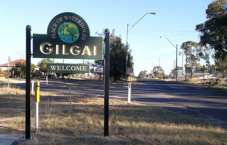
Gilgai is a village in the Northern Tablelands region of New South Wales, Australia The village is situated 10 km south of Inverell, New South Wales on Thunderbolts Way and is in Inverell Shire. At the 2006 census, Gilgai had a population of 289 people. The name Gilgai is an Aboriginal word meaning 'waterhole'.
Map of Gilgai NSW 2360, Australia
The area around Gilgai is dotted with mine shafts that are unique in Australia. They are known as ‘concertina shafts’ because the seams of tin bearing ore were in a zigzag pattern and were mined accordingly. The precious stones found here include sapphires, rubies and some diamonds.
Wine grapes were grown here in 1849 by Charles Wyndham and re-introduced in 1968. Agriculture is the main industry in the area with beef cattle production and wine the main products. Gilgai has a public school which was built in 1878 from bricks baked on the site. There is also a general store, rural supplies store, Anglican Church, Salvation Army Church, community hall and tennis complex. Gilgai Post Office opened on 16 November 1879.