
Population 16,075 (2011 census) Postcode(s) 2360 Postal code 2360 | Established 1856 LGA(s) Inverell Shire Elevation 582 m Local time Wednesday 9:53 AM | |
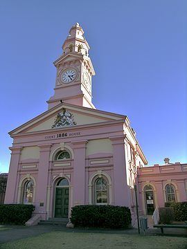 | ||
Location 455 km (283 mi) N of Sydney318 km (198 mi) SW of Brisbane97 km (60 mi) NW of Armidale129 km (80 mi) E of Moree61 km (38 mi) W of Glen Innes Weather 21°C, Wind E at 5 km/h, 69% Humidity Points of interest Inverell Pioneer Village, National Transport Museum, Barayamal National Park | ||
Macintyre river inverell in flood
Inverell is a town in northern New South Wales, Australia, situated on the Macintyre River. It is also the centre of Inverell Shire. Inverell is located on the Gwydir Highway on the western slopes of the Northern Tablelands. It has a temperate climate. In the 2011 census, the population of Inverell was 9,347.
Contents
- Macintyre river inverell in flood
- Map of Inverell NSW 2360 Australia
- History
- Mining
- Industry
- Culture and tourism
- Education
- Transport
- Climate and weather
- Notable weather extremes
- Notable people
- References
Map of Inverell NSW 2360, Australia
History
In 1848, Alexander Campbell held the 50,000-acre (20,000 ha) Inverell Station on the Macintyre River. The name derives from the name of Mr. MacIntyre's estate. The word is of Gaelic origin, and signifies "meeting place of the swans"; from "Inver", a meeting place, and "Ell", a swan. The MacIntyre River and Swanbrook Creek join here. The area was also known as "Green Swamp" in the 1850s. Wheat growers, Colin and Rosanna Ross established a store there in 1853, when he asked that a town be surveyed. In 1858 this was done and in the following years the plan was approved and the first land sale was held. Byron Post Office (open since 1855) was replaced by the Inverell Post Office on 15 September 1859. The municipality was proclaimed in March 1872. The last section of the Inverell branchline, from Delungra to Inverell, was opened on 10 March 1902. The last train ran to Inverell on 22 June 1987, and the Delungra to Inverell section of the line was closed on 2 December 1987. In 1871, the population of Inverell was 509, this increased to 1,212 in 1881. After Federation, the population of Inverell was 1,230 in 1911, and grew to 6,530 (1947) and 8,209 (1961 census).
Mining
Diamonds were discovered at Copes Creek in 1875 and were mined at Copeton from 1883-1922. Commercial sapphire mining was commenced in 1919 at Frazers Creek near Inverell. Rich alluvial deposits in streams were worked initially by hand miners but there was little recorded production up until approximately 1960.
Industry
The Inverell district is in a fertile agricultural region which produces a wide range of crops, including wheat, barley, oats, sorghum, wine grapes and maize. There are also some mining activities with tin, sapphires, zircons and diamonds (mainly industrial) being found. Inverell is known as the ‘Sapphire City’ because of the sapphires that found throughout the local district, contributing to a major part of Australia's sapphire production.
Copeton Dam, the region's main water supply, was completed in 1976. While being smaller than Sydney Harbour, it can hold nearly 2 times the capacity of Port Jackson (Sydney Harbour). The Inland Fishing Festival is held there every year.
Culture and tourism
The Grafton to Inverell Cycle Classic is an annual one day cycling event. Beginning in Grafton, passing through Glen Innes and finishing in Inverell, the Classic is a 230 km ride over the demanding Gibraltar Range. The race starts at 23 metres above sea level and climbs to 1260 metres, before finishing in Inverell at 630 metres. The race is six to seven hours long, depending on weather conditions.
Education
There are two primary schools in Inverell; Ross Hill School and Inverell Public School. The two local high schools are Inverell High School and Macintyre High School. Holy Trinity School is a Roman Catholic School in Inverell which caters for students from Kindergarten to Year Ten.
Transport
Inverell is served by Inverell Airport.
Inverell also lies on the Gwydir Highway, one of the primary east-west routes through New South Wales. Thunderbolts Way terminates at Copes Creek, 16 km south of the Gwydir Highway intersection at Inverell.
Bus services in Inverell are provided by Inverell Bus Service, which operates two town loops, to the east and west.
Interurban bus service is provided by Symes Coaches to Glen Innes.
NSW Trainlink operates three Coach services in and out of Inverell: between Moree and Grafton, between Inverell and Tamworth via Manilla, and between Inverell and Armidale via Tingha
Climate and weather
Over the years, Inverell has had three weather stations run by government astronomers (prior to 1908) or the Bureau of Meteorology (after 1908), or both. These stations are:
Notable weather extremes
The highest maximum temperature recorded at Inverell was 43.7C on 4 January 1903 at the Inverell Comparison site. The lowest maximum temperature for any of the Inverell weather sites was 3.0C on 3 July 1984 at Inverell Research Centre. In September 1892, the town had its biggest snowfall, with 4 to 5 inches (10 to 13 cm) falling. On 5 August 1923, snow fell in parts of the Inverell district.