
Existed: 1959 – present Constructed 1959 | History: Completed in 1986 Length 43.71 km | |
 | ||
Interstate h 1 to h 2 drive from grand waikikian to dole plantation oahu hawaii
Interstate H-1 (abbreviated H-1) is the busiest Interstate Highway in the US state of Hawaii. The highway is located on the island of O‘ahu. Despite the number, this is an east–west highway—the 'H'-series (for Hawaii) numbering reflects the order in which routes were funded and built. H-1 goes from Route 93 (Farrington Highway) in Kapolei to Route 72 (Kalanianaole Highway) in Kāhala. East of Middle Street in Honolulu (exit 19A), H-1 is also known as the Lunalilo Freeway and is sometimes signed as such at older signs in central Honolulu. West of Middle Street, H-1 is also known as the Queen Liliʻuokalani Freeway; this name is shown on some roadmaps. It is both the southernmost and westernmost signed Interstate Highway in the United States.
Contents
- Interstate h 1 to h 2 drive from grand waikikian to dole plantation oahu hawaii
- Map of I H 1 Hawaii USA
- Driving in honolulu entering interstate h 1 lunalilo freeway
- Route description
- History
- Interstate H 4
- Exit list
- Auxiliary routes
- References
Map of I-H-1, Hawaii, USA
Driving in honolulu entering interstate h 1 lunalilo freeway
Route description
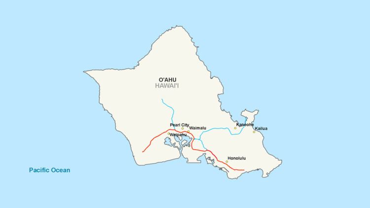
Interstate H-1 begins near the Campbell Industrial Park in the town of Kapolei, Hawaii. West of this point, Hawaii State Route 93 (Farrington Highway) continues toward Waianae. The freeway continues east, passing the community of Makakilo until reaching the junction with SR 750 (north to Kunia) and SR 76 (south to Ewa Beach).
H-1 then continues along the northern edge of Waipahu approximately 3 miles (4.8 km) until its junction with Interstate H-2. It then continues east through the towns of Pearl City and Aiea for approximately 5 miles (8.0 km) to the complex Halawa Interchange, where it meets Interstates H-3 and H-201. The highway then turns south for two miles (3 km), then east soon after the exits for Hickam Air Force Base and Pearl Harbor. At this point, the highway runs along a viaduct above State Route 92 (Nimitz Highway), passing to the north of Honolulu International Airport.
Two miles past the airport exit, three lanes exit the freeway at exit 18A to join Nimitz Highway toward Waikiki, while the remaining two lanes make an S-curve to join the east end of Interstate H-201. From here H-1 runs through the city of Honolulu along a series of underpasses and viaducts. H-1 ends in the Kahala district of Honolulu near Kahala Mall, where State Route 72 (Kalanianaole Highway) ends.
H-1 has a maximum posted speed limit of 60 mph (100 km/h) west of the Kunia-Ewa-Waipahu interchange; a 55 mph (90 km/h) speed limit for the remaining section running to the airport, and a 50 mph (80 km/h) speed limit on the Lunalilo Freeway section that runs within the Honolulu area, with a few 45 mph (73 km/h) sections.
During morning commute hours on weekdays, an eastbound contraflow express lane is deployed from just west of exit 7 to exit 18A, where it connects to the beginning of the Nimitz Highway contraflow lane. The H-1 contraflow lane is often referred to as a "Zipper Lane" due to the use of a movable concrete barrier and a Zipper Machine. The H-1 and Nimitz Highway contraflow lanes are restricted to buses, motorcycles, and vehicles with two or more occupants while in operation.
History
Interstate H-1 was authorized as a result of the Statehood Act of 1960. The portion of H-1 that runs through downtown Honolulu opened in 1953 as the Mauka Arterial; it was added to the Interstate system when Hawaii became a state. This section has been largely unchanged since its inception and its design suffers from having too many on/off ramps, short distanced on-ramps, and on-ramps that enter the freeway almost immediately before an off-ramp (opposite of current design standards). The 'new' section of H-1 was, however, built to modern freeway standards.
The Hawaiian Interstate shields have gone through several changes. Early shields contained the hyphen as per the official designation (e.g. H-1); however, these shields have been updated with the hyphen removed (e.g. H1). As in other states across the contiguous United States, early interstate shields also included the writing of 'Hawaii' above the interstate route number and below the 'Interstate' writing. While the "Queen Liliuokalani" section of the Interstate H-1 has signs designating it as such (one eastbound at exit 1, the other westbound after exit 19), there are no similar name signs for the Lunalilo Freeway portion (the remainder of the freeway).
Interstate H-4
In the 1960s a fourth freeway, which would have been Interstate H-4, was proposed for the city of Honolulu. The intent of H-4 was to provide relief to the congested H-1 through downtown Honolulu. Had it been built, the 6.5-mile-long (10.5 km) route of H-4 would have started at Exit 18 (H-1/Nimitz Highway interchange) and followed the Honolulu waterfront to the Kapiolani interchange (Exit 25B). The idea, however, was unpopular and the freeway was never built.
Exit list
The entire route is in Honolulu County.