
Length 379 km | ||
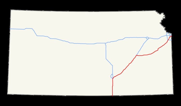 | ||
Interstate 35 (I-35) is an Interstate Highway in the US that runs from the Mexican border near Laredo, Texas, to Duluth, Minnesota. In Kansas, the highway goes from the Oklahoma border to Kansas City at the Missouri border, with a length of 235 miles (378 km). Along the way, I-35 passes through Wichita, the state's largest city, linking it to Emporia, Ottawa, and Kansas City and its Johnson County suburbs.
Contents
Oklahoma border to Emporia
I-35 enters Kansas from Oklahoma where the southern terminus of the Kansas Turnpike is located. After passing exit 4 for US Highway 166 (US-166) in South Haven, the interstate passes through a toll plaza, making I-35 into a toll road. The highway then passes US-160 in Wellington, then the Belle Plaine Service Area, the first of three on I-35, and the first of six on the turnpike. After the service area, the turnpike continues due north to Wichita and intersects I-135. After the I-135 interchange, the turnpike turns northeast and goes around Downtown Wichita. I-35 passes through Wichita's suburbs and in the process intersects US-54 and US-400. Ten miles (16 km) north of the Wichita area lies the Towanda Service Area. Thereafter, the route intersects US-77 and various state highways in El Dorado. After El Dorado, the highway enters the Flint Hills region of Kansas. After passing the Cassoday interchange, the turnpike begins its 25-mile-long (40 km) stretch with no exits. The only stop along the way is the Matfield Green Service Area. Located 5 miles (8.0 km) north of Cassoday, it is also the last service area on I-35. After the remaining twenty miles (32 km) with no exits or services, I-35 leaves the turnpike in Emporia. Here the interstate meets I-335, which the Turnpike carries towards Topeka.
Emporia to Kansas City
I-35 passes through a toll plaza, to continue on its own alignment running eastward through east-central Kansas. At Ottawa, it turns to a more northeasterly direction. After passing through the Kansas suburbs of the Kansas City Metro Area, it then crosses the state line into Missouri and into Downtown Kansas City.
History
The original plan for Interstate 35 was to follow US 50 from Newton, as well as US 81 and US 177 to the Oklahoma state line. But when Kansas Turnpike was created, a part of Interstate 35 was created south of Emporia. The Newton segment was declined, and there was another implication for US 50 that traveled north (which is known today). The segments from Olathe to Shawnee was created by 1962. The relocations of US 75 and K-31 were finished by 1975. Interstate 35 in Kansas (as known today) had its final modification in 1976.
The Kansas Department of Transportation worked with the Burns & McDonnell engineering company to design a new interchange at Homestead Lane in Johnson County as a diverging diamond. The first interchange of its kind in the state, it opened September 28, 2013.
Exit list
KSHB
Auxiliary routes
There are five auxiliary routes branching from I-35 in Kansas: