
Existed: 1965 – present Length 26.1 km | Constructed 1965 | |
 | ||
East end: I‑40 / US-270 / SH-3 in Oklahoma City, OK | ||
Interstate 240 (abbreviated I-240) is an Interstate Highway in Oklahoma, United States, that runs 16.22 miles (26.1 km) west from Interstate 40 to Interstate 44 in southern Oklahoma City. After its terminus in southwest Oklahoma City, the main I-240 roadbed becomes Interstate 44 and Airport Road toward Will Rogers World Airport. The interstate overlaps SH-3, the longest Oklahoma state highway, for its entire length.
Contents
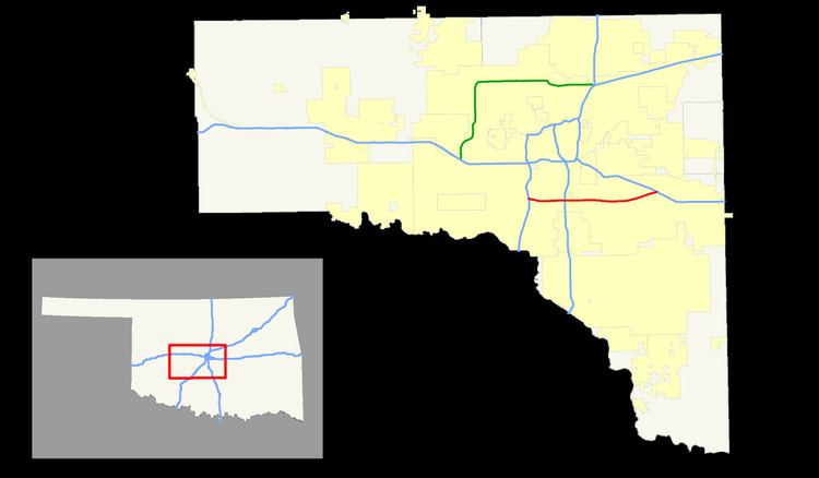
Map of I-240, Oklahoma City, OK, USA
Major destinations along the route include Crossroads Mall, Tinker Air Force Base, and the heavily populated Southside of Oklahoma City. With just under 8,000,000 square feet (740,000 m2) of commercial space, I-240 is a major corridor of retail, industrial and office space. As of 2012, however, the corridor included some "pockets of shuttered stores and creeping shabbiness" and local planners were in the first stages of efforts to revitalize the corridor.
I-240's service road is named S.E. 74th Street.
Route description
From the western terminus at I-44, I-240/US-62/SH-3 runs east towards Interstate 35. The western half is the busier of the two sections, serving the Southside area of Oklahoma City and traffic headed to the airport. This segment has a configuration of ramps that causes much weaving and many accidents. An entrance ramp will merge onto the highway, forming a new lane. This new lane will then become an Exit Only lane for the next exit. However, the exits are not spaced very far apart, causing entering and exiting traffic to conflict. (For a satellite photo, see. ) Signs were installed in October 2004 designating the western half of I-240 as the Keith Leftwich Memorial Loop, in honor of a state senator who died recently. I-240 meets I-35 at a cloverleaf interchange. US-62 splits off to join with I-35 northbound at this interchange.
The section of I-240 east of I-35 exists primarily to serve the now-closed General Motors plant and Tinker Air Force Base. Crossroads Mall can also be accessed via Exit 4C for Pole Road. This section is much less traveled, having only four lanes (two in each direction) for much of its length. At I-240's eastern terminus with I-40, motorists traveling eastbound on I-240 are forced to merge onto I-40 eastbound—there is no I-40 West off-ramp. (Those wishing to take I-40 West must exit off of I-240 a mile earlier at Anderson Road, a surface street, and travel on it northbound until they reach I-40, or continue east on I-40 before turning around at Choctaw Road.)
History
The section of what is now I-240 between I-35 and current I-44 was already complete in 1965 as an alignment of US-62. When the Interstate route was initially established in the 1960s, I-240 ran from its current eastern terminus around the city, turning north at the present interchange with I-44, continuing on the present course of I-44 to its present southern junction with I-35. (Interstate 44 ended near Edmond at the western end of the Turner Turnpike at the time.) I-240 thus nearly created a loop around the city, intersecting both I-35 and I-40 twice. The section east of I-35 to its eastern terminus at I-40 was completed in 1973. The entirety of the route was complete in 1976. In 1978, Interstate 240 was 31.76 miles (51.11 km) long.
As part of Oklahoma's 75th anniversary (Diamond Jubilee) celebrations in 1982, ODOT extended I-44 to Lawton and Wichita Falls, Texas along the H.E. Bailey Turnpike. This caused I-240 to be truncated to its current western terminus near Will Rogers World Airport.
Exit list
The entire route is in Oklahoma City, Oklahoma County.