
Location Hinteres Oberbergtal Built in 1884 (1884) | Elevation 2,369 m (7,772 ft) AA Phone +43 5276 295 | |
 | ||
Hut type OeAV, DAV Hut Category I Address ⛉ Schulweg 12, 6167 Neustift im Stubaital, Austria Similar Bremer Hütte, Tourismu Stubai Tirol, Sulzenau, Dresdner Hütte, Franz‑Se (2147m) | ||
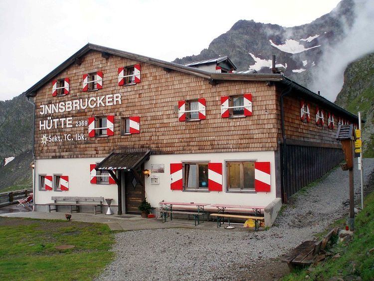
The Innsbrucker Hut (German: Innsbrucker Hütte) is a mountain hut in the Stubai Alps at an altitude of 2,369 metres (7,772 ft) in the Gschnitz Valley, not far from the Pinnisjoch. It is managed by the Innsbruck Tourist Club section of the Austrian Alpine Club. The Innsbrucker Hütte is below the Habicht on the Stubai Hohenweg and is often visited.
Contents
Access
The quickest route to the hut from the Gschnitz Valley is from the car park behind Gasthof Feuerstein (at 1,281 metres (4,203 ft)); this route takes about three hours and climbs over 1,000 metres (3,300 ft). in about three hours, with over 1000 meters of altitude to overcome. An alternate route from Neder in the Stubai Valley (at 970 metres (3,180 ft)) through the Pinnis Valley takes approximately 4–5 hours and passes four former Alpine pastures, the Herzebenalm, Issenangeralm, Pinnisalm and Karalm. It is possible to take a taxi as far as the Karalm (at 1,747 metres (5,732 ft)).