
South end: SR 14 in Jasper County Constructed 1 October 1926 | Length 71.43 km | |
 | ||
Existed: October 1, 1926 – present North end: Indiana Dunes State Park | ||
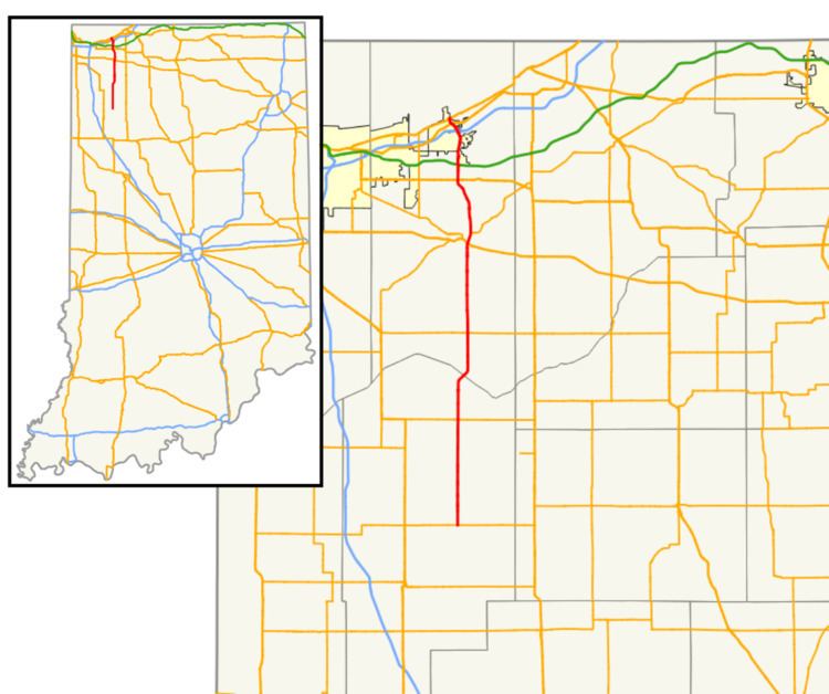
State Road 49 (SR 49) in the U.S. State of Indiana is a state highway in northwest Indiana. It runs from just north of Chesterton, at the intersection with U.S. Route 12 (Dunes Highway) south, to a rural interchange, 10 miles (16 km) northeast of Rensselaer, with State Road 14. This is a distance of about 44.15 miles (71.05 km).
Contents
Map of IN-49, Indiana, USA
Route description
The southern terminus of SR 49 is in Wheatfield at State Road 14 (SR 14). SR 49 heads north from Wheatfield toward Valparaiso, just south of Valparaiso SR 49 becomes a four-lane divided highway. Then in Valparaiso SR 49 has an interchange with U.S. Route 30 (US 30). After the US 30 interchange, SR 49 and State Road 2 have an interchange. Then SR 49 leaves Valparaiso heading north toward Chesterton having an interchange with U.S. Route 6, Interstate 80/Interstate 90/Indiana Toll Road, Interstate 94, U.S. Route 20, and U.S. Route 12. US 12 is the northern terminus of SR 49.
History
Before 1926, SR 49 was a named Liberty Way from Kouts to Valparaiso, it was a named state route. After 1926, SR 49 was a two-lane highway from Valparaiso to Chesterton, known as "Old State Road 49". When the Valparaiso Bypass was completed the old route was decommissioned and turned over to the City of Valparaiso, the City of Chesterton, and Porter County.