
Length 197.9 km | ||
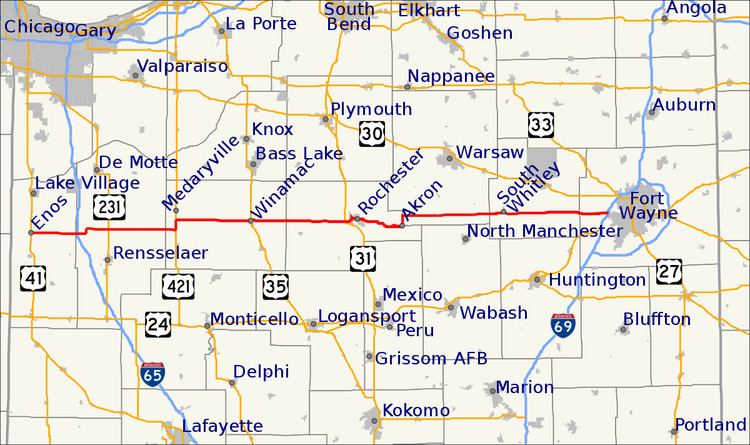 | ||
State Road 14 is an east–west highway route which traverses the northern portion of the U.S. State of Indiana. Its western terminus is at U.S. Route 41 in Enos, and since 1995 its eastern terminus is at Interstate 69 in Fort Wayne.
Contents
Map of IN-14, Indiana, USA
History
Until 1995, State Road 14 continued east of I-69 to the Ohio state line, following Illinois Road to Jefferson Boulevard (a former routing of US 24 and SR 37), then along Washington Boulevard (westbound) and Jefferson Boulevard/Maumee Avenue (eastbound) through central Fort Wayne. East of the city center, just past the point where the one way streets rejoin as Washington Boulevard, State Road 14 met and joined State Road 930 (a previous routing of US 30 around the city). It subsequently split from SR-930 in New Haven, where it continued due east on Lincoln Avenue and Dawkins Road to its former eastern terminus at State Line Road in the village of Edgerton, Indiana. This segment was decommissioned in 1995 concurrent with the opening of Interstate 469.
In August 2005, construction on a new interchange connecting State Road 14 to Interstate 65 was completed in Jasper County. Winamac is the only control city listed, and is approximately 40 miles (64 km) east of the junction. The interchange provides for direct access to Fair Oaks Farms, located immediately west of I-65 along SR 14.