
South end: SR 10 Length 81.87 km | ||
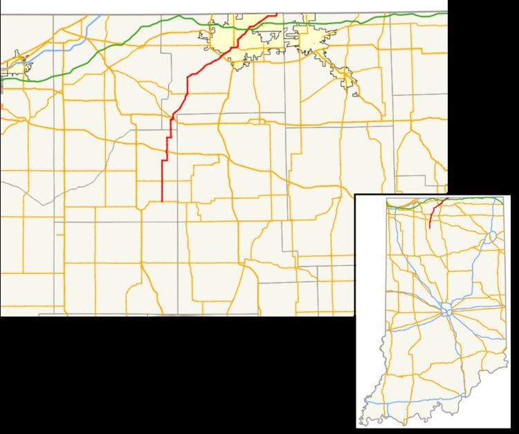 | ||
State Road 23 is a highway in the north-central part of the U.S. state of Indiana. In practice it runs from the southwest to the northeast, though it is designated as a north–south route. It is an undivided surface road.
Contents
Map of IN-23, Indiana, USA
Route description
Indiana State Road 23 (SR 23) begins about 2.5 miles (4.0 km) east of the northeastern shore of Bass Lake in Starke County at the intersection of State Road 10 and County Road 900E. From there, it heads north toward Grovertown, where it intersects US 30. SR 23 continues north until Walkerton in the extreme southwestern corner of St. Joseph County, where it meets US 6. After a very brief concurrency with that route, SR 23 departs town to the north, then quickly turns northeast toward South Bend, passing though North Liberty. As it enters the South Bend metropolitan area, SR 23 has an interchange with US 20/US 31 (the St. Joseph Valley Parkway). It then traverses the city of South Bend from southwest to northeast, passing very near the campus of the University of Notre Dame. After crossing under the Indiana East-West Toll Road (I-80/I-90) without providing any access, SR 23 parallels that tollway briefly before reaching a intersection with SR 331, which does provide access to the Toll Road (at its Exit 83). From there SR 23 proceeds northeast into the town of Granger before it curves due north to reach the Michigan state line.
History
Between 1917 and 1926, SR 23 began east of Pennville and ran to a point north of Pennville, following today's State Road 1 and State Road 26 routes. Between 1917 and 1926, today's SR 23 route was a county road.