
Length 81.38 km | Constructed 1 October 1926 | |
 | ||
Existed: October 1, 1926 – present Counties | ||
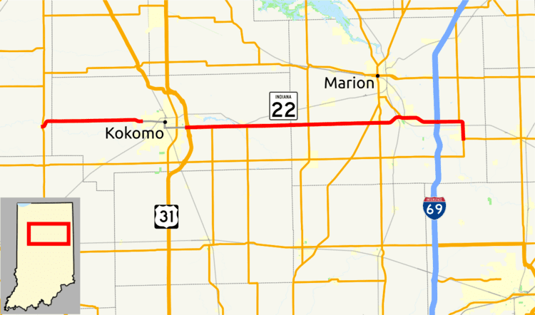
State Road 22 in the U.S. state of Indiana is a major thoroughfare from Kokomo to Interstate 69. The highway is concurrent with U.S. Route 35 from Kokomo to Interstate 69.
Contents
Map of IN-22, Indiana, USA
Route description
Indiana State Road 22 (SR 22) begins at SR 29 in Burlington. SR 22 heads due east to Kokomo where SR 22 has an intersection with U.S. Route 31 (US 31) and US 35 At this point US 35 turns east onto SR 22 heading due east. After 29.66 miles (47.73 km) US 35 leaves SR 22 at an interchange with Interstate 69 (I-69). Then after the I-69 interchange, SR 22 continues due east. Just east of SR 5, SR 22 turns due south. Right after turning north-south route SR 22 ends at SR 26.
History
SR 22 used to terminate at the Ohio State line until at least 1981. It followed SR 26 to Hartford City, then turned left onto Mill Street, and traveled on Old 22, onto Blackford County Road 500E (then SR 303) for a mile, then turned right on CR 250 S, which becomes CR 350 N in Jay County. SR 22 went through Pennville when it had a concurrency with SR 1 for a few yards, then turned left on CR 300 N, and traveled all the way to the Ohio state line, where it continues as Ohio State Route 219.