
Counties: Gibson | Length 27.65 km | |
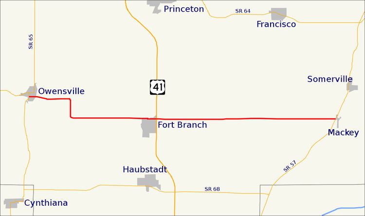 | ||
State Road 168 is a 17-mile-long (27 km) east–west two-lane highway that exists entirely within Gibson County in the far southwestern portion of the state, spanning Barton, Montgomery, and Union townships.
Contents
Map of IN-168, Indiana, USA
Route description
State Road 168 runs from State Road 65 in Owensville, through the north side of Fort Branch, to State Road 57 in Mackey. Its route runs about 3 miles (4.8 km) north of, and parallel to, its parent highway, State Road 68.
State Road 168 intersects with U.S. Route 41 and Interstate 69; the latter opened on November 15, 2012.
Major intersections
The entire route is in Gibson County.
References
Indiana State Road 168 Wikipedia(Text) CC BY-SA