
Existed: 1931 – present East end: SR 145 Constructed 1931 | Length 30.73 km | |
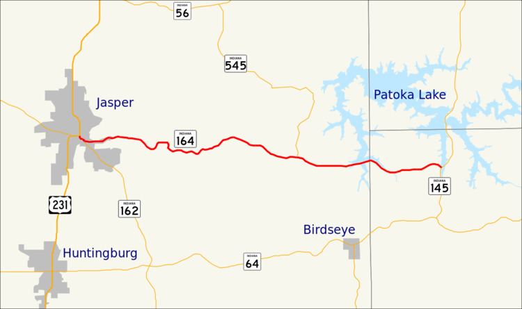 | ||
State Road 164 in the U.S. State of Indiana is a short east–west two-lane highway in the southwest portion of the state.
Contents
Map of IN-164, Indiana, USA
Route description
State Road 164 begins in downtown Jasper where U.S. Route 231 and State Road 56 separate. Passing east out of town, the road winds through the country, passing to the south of Jasper Lake and through the small town of Celestine. Just before leaving Dubois County for Crawford County, it crosses an arm of Patoka Lake; it then passes through the small town of Wickliffe on the edge of the Hoosier National Forest before terminating at State Road 145 on the shores of another arm of the lake.
References
Indiana State Road 164 Wikipedia(Text) CC BY-SA