
Existed: 1931 – present Constructed 1931 | Length 74.93 km | |
 | ||
Counties | ||
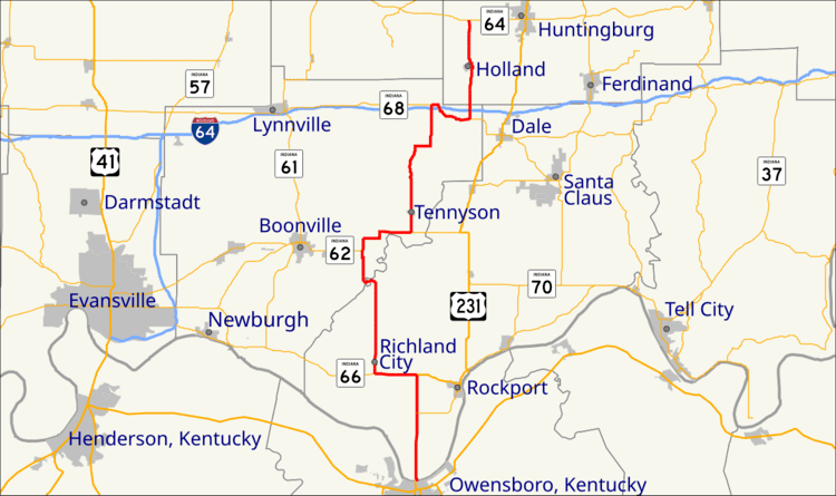
State Road 161 in the U.S. State of Indiana is a rural undivided north–south highway in the southwestern portion of the state.
Contents
Map of IN-161, Indiana, USA
Route description
State Road 161 begins in Spencer County approximately nine miles southwest of Rockport at the northern end of the Owensboro Bridge across the Ohio River. It goes north into Warrick County, where it has concurrencies with State Road 62 and State Road 68. At the north end of the county it passes over Interstate 64 three times in five miles (8 km), but the only interchange is at the last overpass. State Road 161 ends in Dubois County at State Road 64 approximately four miles west of Huntingburg.
History
The route of SR 161 was extended by nearly 12 miles (19 km) in the fall of 2002 when the Indiana Department of Transportation redesignated the former route of U.S. Route 231 in Spencer County.