
River mouth 3 ft (0.91 m) Country United States of America | Length 6 km | |
 | ||
The Indian Head River is located on the Hanover, Pembroke border in Massachusetts, United States, and covers about 8 acres (32,000 m2). The river, 3.7 miles (6.0 km) long, is a tributary of the North River, which flows into Massachusetts Bay. The Indian Head River was probably a fishing and travel spot for Wompatuck Indians.
Contents
Map of Indian Head River, Massachusetts, USA
History
The river runs through the Luddams Ford Park, named after a guide, James Luddam, who in 1632 carried Governor Winthrop across the river to get to Weymouth. In November 1873, Eugene H. Clapp bought the Old Forge Property from George Curtis and built the Clapp Rubber Factory on the river.
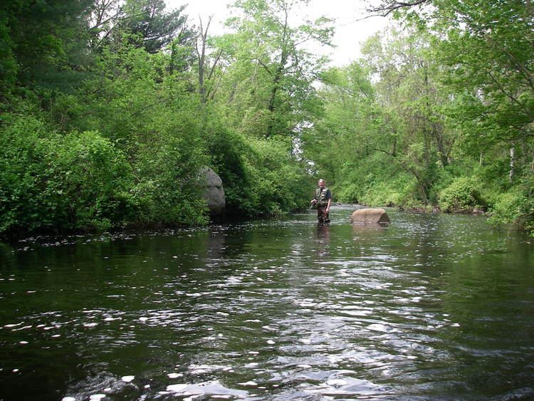
Habitat
The factory is no longer there, but the mercury pollution from the factory still clings to the rocks and fish making it unsafe to drink the water and eat the fish. There is a strip of rubber along the river on the Pembroke side which people may bounce on.
The river now has a man-made dam and fish ladder. The river is stocked with trout. It also has a small beaver (Castor canadensis) population. For two weeks during the summer, the herring run up stream to spawn. If herring are caught they must be released and no motor boats are allowed. Once a year, the Hanover Police hold a free fishing derby for anybody that has a fishing license and a fishing rod.
There is a plaque that is embedded in the wall on a bridge that crosses the river. The plaque says: