
Airport type Public 14/32 3,722 1,134 Asphalt | Elevation AMSL 3,900 ft / 1,189 m 3,722 1,134 Elevation 1,189 m | |
 | ||
Address Independence, CA 93526, USA Similar Eastern California Museum, Winnedu Country Inn, Ray's Den Motel, Independ Creek Campgro, Mt Williamson Motel | ||
Independence airport 1965
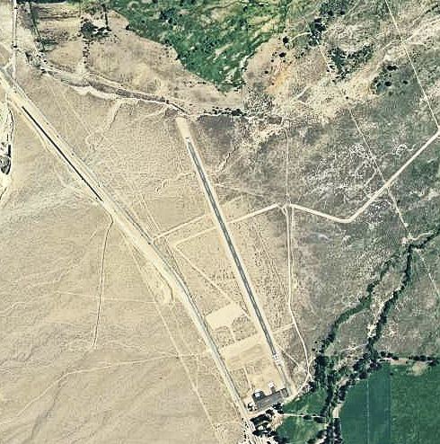
Independence Airport (FAA LID: 2O7) is a public airport located one mile (1.6 km) north of Independence, serving Inyo County, California, USA. The airport has two runways and is mostly used for general aviation.
Contents
Facilities
Independence Airport has two runways:
History
During World War II, the airport was used by the United States Army Air Forces as an auxiliary training airfield for the flying school at Lone Pine Airport, California.
References
Independence Airport Wikipedia(Text) CC BY-SA