
Airport type Public Elevation AMSL 3,680 ft / 1,122 m 4,000 1,219 Elevation 1,122 m | 16/34 4,000 1,219 Asphalt Phone +1 760-876-4700 | |
 | ||
Address 1900 S Main St, Lone Pine, CA 93545, USA Similar Whitney Portal Hostel, Comfort Inn, Best Western Plus Fron, Blue Sky Real Estate, U‑Haul Neighbor Dealer | ||
Lone pine airport landing on the u2
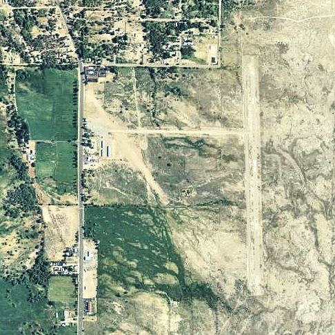
Lone Pine Airport (FAA LID: O26) is a public airport located one mile (1.6 km) southeast of Lone Pine (Geographic coordinates N36-35.30; W118-03.12) serving Inyo County, California, USA. The airport has two runways and is mostly used for general aviation. Charts: San Francisc; L5.
Contents
- Lone pine airport landing on the u2
- Prue 215 sailplane landing at lone pine airport
- Facilities
- World War II
- References
UNICOM/CTAF Frequency: 122.8
Prue 215 sailplane landing at lone pine airport
Facilities
Lone Pine Airport has two runways:
World War II
During World War II, the airport was used as a contract flying school by the United States Army Air Forces. The contract flying school operated between 1942 and 1944. The school also controlled several auxiliary airfields:
References
Lone Pine Airport Wikipedia(Text) CC BY-SA