
Country United States County Montgomery Time zone CST (UTC-6) | Elevation 804 ft (245 m) ZIP code 67301 | |
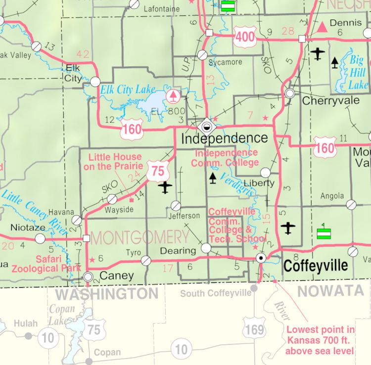 | ||
Independence is a city in and the county seat of Montgomery County, Kansas, United States. As of the 2010 census, the city population was 9,483. It was named in commemoration of the Declaration of Independence.
Contents
- Map of Independence KS 67301 USA
- History
- Geography
- 2010 census
- 2000 census
- Primary and secondary education
- Community college
- Transportation
- Area events
- Area attractions
- Notable people
- References
Map of Independence, KS 67301, USA
History
Independence was settled on land that was purchased from the Osage Indians in September 1869 by George A. Brown for the price of $50; they were being moved to Indian Territory in present-day Oklahoma. He originally called the townsite Colfax after Schuyler Colfax, Vice-president under President Ulysses S. Grant. On August 21, 1869 a group of Oswego, Kansas men led by R.W. Wright settled there with the intent to make Independence the county seat. E.E. Wilson and F.D. Irwin opened the first store in October 1869, Wilson & Irwin Groceries. Independence was designated county seat in 1870.
A permanent lighting system was first used for an exhibition baseball game on April 17, 1930 between the Independence Producers and House of David semi-professional baseball team of Benton Harbor, Michigan, with the Independence team winning with a score of 9 to 1 before a crowd of 1,700 spectators.
Miss Able, a rhesus monkey, was born at Ralph Mitchell Zoo. Miss Able along with Miss Baker, a squirrel monkey, became the first monkeys to fly in space; they returned alive on May 28, 1959.
Geography
Independence is located along the Verdigris River just south of its confluence with the Elk River. According to the United States Census Bureau, the city has a total area of 7.75 square miles (20.07 km2), of which, 7.74 square miles (20.05 km2) is land and 0.01 square miles (0.03 km2) is water.
2010 census
As of the census of 2010, there were 9,483 people, 3,950 households, and 2,430 families residing in the city. The population density was 1,225.2 inhabitants per square mile (473.1/km2). There were 4,528 housing units at an average density of 585.0 per square mile (225.9/km2). The racial makeup of the city was 84.2% White, 6.5% African American, 1.6% Native American, 0.9% Asian, 2.3% from other races, and 4.5% from two or more races. Hispanic or Latino of any race were 6.5% of the population.
There were 3,950 households of which 33.0% had children under the age of 18 living with them, 40.9% were married couples living together, 14.9% had a female householder with no husband present, 5.7% had a male householder with no wife present, and 38.5% were non-families. 33.0% of all households were made up of individuals and 14.8% had someone living alone who was 65 years of age or older. The average household size was 2.35 and the average family size was 2.95.
The median age in the city was 36.9 years. 26% of residents were under the age of 18; 8.6% were between the ages of 18 and 24; 24.5% were from 25 to 44; 24.9% were from 45 to 64; and 15.9% were 65 years of age or older. The gender makeup of the city was 48.4% male and 51.6% female.
2000 census
As of the census of 2000, there were 9,846 people, 4,149 households, and 2,609 families residing in the city. The population density was 1,979.4 people per square mile (764.9/km2). There were 4,747 housing units at an average density of 954.3 per square mile (368.8/km2). The racial makeup of the city was 87.00% White, 7.17% African American, 1.16% Native American, 0.62% Asian, 0.01% Pacific Islander, 1.10% from other races, and 2.95% from two or more races. Hispanic or Latino of any race were 3.84% of the population.
There were 4,149 households out of which 30.2% had children under the age of 18 living with them, 46.8% were married couples living together, 12.3% had a female householder with no husband present, and 37.1% were non-families. 32.7% of all households were made up of individuals, and 15.2% had someone living alone who was 65 years of age or older. The average household size was 2.32, and the average family size was 2.93.
In the city, the population was spread out, with 25.7% under the age of 18, 8.9% from 18 to 24, 26.1% from 25 to 44, 21.3% from 45 to 64, and 18.0% who were 65 years of age or older. The median age was 37 years. For every 100 females, there were 89.9 males. For every 100 females age 18 and over, there were 84.9 males.
The median income for a household in the city was $29,574, and the median income for a family was $37,134. Males had a median income of $26,552 versus $20,017 for females. The per capita income for the city was $15,496. About 11.4% of families and 13.1% of the population were below the poverty line, including 18.7% of those under age 18 and 13.2% of those age 65 or over.
Primary and secondary education
Community college
The Independence Community College main campus is located two miles south of the city. ICC West Campus is located in the city one mile west of the downtown. Each semester, over 1000 students are enrolled at ICC and about 100 people work there, making the college population an important contributor to the local economy as well as a significant portion of the people traveling about town.
Transportation
Independence is located at the intersection of US-75 and US-160. Rail freight service is provided by the Union Pacific Railroad and South Kansas and Oklahoma Railroad. The Independence Municipal Airport (IDP) is located 5 miles (8.0 km) southwest of the center of the city.