- location Upper Arrow Lake Basin area 1,020 km² Basin area 1,020 km² | - min 4.76 m/s (168 cu ft/s) Discharge 55.8 m³/s | |
 | ||
- average 55.8 m/s (1,971 cu ft/s) - max 570 m/s (20,129 cu ft/s) Mouths Arrow Lakes, Columbia River | ||
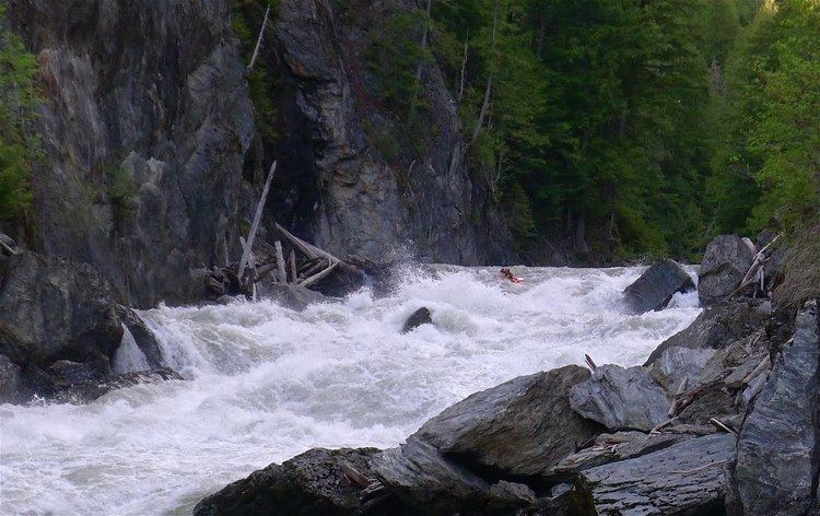
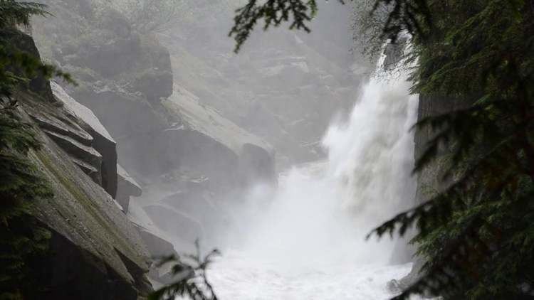
The Incomappleux River is a major tributary of the Columbia River in British Columbia, Canada, entering that river via the Beaton Arm of Upper Arrow Lake.
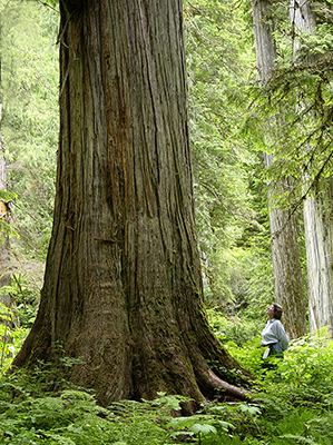
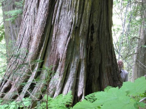
The area is the upper end of the Lardeau district. The river's course is nearly due south from its origin in the Selkirk Mountains at the southwest toe of the Illecillewaet Neve, which is on the south side of the Rogers Pass and is also the source of the Illecillewaet River. Sometimes called the Fish River, this is a wild outfall, amid large cedars, hemlock, devil's club and bears. Pope and Talbot owned the timber lease, and wanted to cut the prime cedar, there being a grove of spectacular thousand year old cedar in the area. P and T have since gone bankrupt and the road through the canyon by river has washed out.
Incomappleux is from the Okanagan word nk'mapeleqs, meaning "point at end (of lake)". The name of the former town of Comaplix and adjacent mountain and creek are derived from the name of the river.
The pioneer towns of Beaton, Camborne, Circle City were in the area. The mines Eva, Oyster, Meridian, Silver Dollar and others were rich in silver lead ore.