
Population 2,751 (Parish-2011) Sovereign state United Kingdom Area 23.5 km² Dialling code 01797 | OS grid reference TQ875162 Post town WINCHELSEA Local time Friday 5:44 AM District Rother | |
 | ||
Weather 6°C, Wind E at 13 km/h, 97% Humidity | ||
Icklesham is a village and civil parish in the Rother District of East Sussex, England. The village is located about six miles (10 km) east of Hastings, on the main A259 Hastings to Rye road.
Contents
Map of Icklesham, Winchelsea, UK
The civil parish is large, and includes Icklesham itself, Winchelsea, Winchelsea Beach and Rye Harbour.
Icklesham's historic roots can be traced back to 772, when it appeared as Icoleshamme in a land charter signed by Offa, King of Mercia. Strategically located on the River Brede, it was a prime target in the Norman invasion of 1066 (some 700 years later, evacuation plans were prepared in case of an invasion by Napoleon). The 12th-century parish church is dedicated to St Nicholas.
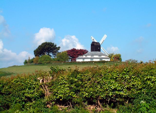
On Hogs Hill stands an old windmill, used as a recording studio by Sir Paul McCartney. All Saints church was restored by architect Samuel Sanders Teulon in the late 1840s.
Landmarks
The parish contains three Sites of Special Scientific Interest—Winchelsea Cutting, "Dungeness, Romney Marsh and Rye Bay" and Rye Harbour. Winchelsea Cutting is a 0.3-acre (0.12 ha) roadside cutting with 33 feet (10 m) of exposed geological strata. Dungeness, Romney Marsh and Rye is a large site of 1,801 acres (729 ha), lying along the coast, and extending into the neighbouring county of Kent. Its interest is biological and geological, with various habitats of shingle, saltmarsh, sand dunes and saline lagoons. Rye Harbour is another 1,881-acre (761 ha) site of biological importance, with a varied habitat of shingle, intertidal mudflats and saltmarsh.
A sandstone circle is located to the east of the parish church in a field by the main A259 road. It was constructed in approximately 2012.