
 | ||
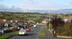
Cookridge countryside leeds west yorkshire uk 3rd november 2012
Cookridge is a suburb of north-west Leeds, West Yorkshire, England. It is a mixture of suburban, twentieth-century private housing and a very small amount of council housing bordering Tinshill. It is in the Adel and Wharfedale ward of City of Leeds metropolitan district, and the Leeds North West parliamentary constituency. Before 2004 there was a Cookridge ward; it was proposed that the present ward be called Cookridge and Wharfedale, but this was rejected and parts of the Cookridge ward were moved to other wards. The southern part of the former Cookridge ward is Tinshill, and there is some crossover with names of institutions.
Contents
- Cookridge countryside leeds west yorkshire uk 3rd november 2012
- Map of Cookridge Leeds UK
- November early snowfall in cookridge leeds uk 27th 30th november 2010
- History and buildings
- Sport
- Cookridge Hospital
- Religion
- Education
- Notable people
- References
Map of Cookridge, Leeds, UK
Nearby places include Adel, Holt Park, Tinshill, Horsforth, Bramhope, Moor Grange and Ireland Wood.
November early snowfall in cookridge leeds uk 27th 30th november 2010
History and buildings
In 1715 Ralph Thoresby described it as a village four miles from Leeds and three from Otley, dating from 1540 and once part of the possessions of Kirkstall Abbey. Thoresby noted traces of a Roman road and the interesting paths which had been created in the adjacent Moseley Wood.
The Cookridge Estate was bought by Richard Wormald in 1820 and sold in portions by his descendant Francis Wormald in the 1920s. In 1926 Cookridge became part of Leeds, and from 1927 the houses of Cookridge Village began to be built. This was largely under the direction of architect Cecil Crowther and his builder brothers, taking advantage of subsidies from the Housing Acts of 1923-1925. Mavis Lane and Mavis Avenue are named after Cecil Crowther's daughter. Crowther acted as estate agent and produced a 1930 brochure entitled Cookridge - Village of Youth extolling its virtues for newly-weds. This included a map showing 135 plots of an area largely bounded by Cookridge Lane to the east, Moseley Wood Lane to the south, and Cookridge Avenue to the north-west. There were six firms of builders, with different styles.
During the Second World War it was used by the military and from June to August 1940 was the base for No. 9 General Hospital after the unit escaped from France and before they left for service in the Middle East.
In the 1950s and 1960s Moseley Wood was developed into a large private housing estate. In the 1970s further land between Tinshill Road and Green Lane was developed to create the areas known locally as 'The Dale Parks'.
Cookridge Hall is a Grade II listed building, dating from the 17th century which was formerly a country house and in 1997 was opened by the Lord Mayor of Leeds as a leisure club with a golf course.
The water-tower was built in 1929 to supply Cookridge village on one of the highest points in Leeds at 192m (630 feet) above sea level. Near the water-tower is Tinshill BT Tower (also known as Cookridge Tower), a prominent landmark.
Sport
Cookridge has three sports clubs: Cookridge Cricket Club, Cookridge Hall Golf Club, and the Old Modernians Sports Club which has football, rugby and cricket teams.
Cookridge Hospital
Cookridge Hospital specialised in the treatment of cancer but these facilities have been transferred to the new St James's Oncology Unit (Bexley Wing) of Leeds Teaching Hospitals NHS Trust. The main building and the lodge, designed by Norman Shaw in 1868, are Grade II listed buildings.
Religion
The Church of England parish church is Holy Trinity, a 1961 brick building on Green Lane. Cookridge Methodist Church is a brick building on the junction of Tinshill Road and Otley Old Road. Grace Community Church meet at Cookridge Village Hall.
Education
The main primary schools in Cookridge are Holy Trinity Church of England (Aided) Primary School and Cookridge Primary School