
Population 555 (2011 census) Postal code 3396 | Postcode(s) 3396 Local time Wednesday 2:15 AM | |
 | ||
Location 395 km (245 mi) NW of Melbourne195 km (121 mi) south of Mildura62 km (39 mi) north of Warracknabeal118 km (73 mi) north of Horsham Weather 21°C, Wind NE at 10 km/h, 54% Humidity | ||
Hopetoun is a town which serves as the major service centre for the Southern Mallee area of Victoria, Australia. Hopetoun is situated 400 kilometres north-west of Melbourne on the Henty Highway in the Shire of Yarriambiack. In the 2011 census, Hopetoun had a population of 555.
Contents
Map of Hopetoun VIC 3396, Australia
History
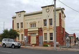
The town was named after the 7th Earl of Hopetoun, the Governor of Victoria from 1889 to 1895 and later the first Governor-General of Australia. The post office opened on 12 September 1891 when the township was established.
During the early 2009 Australian heatwave, the town experienced several days of intense heat, with a peak of 48.8 °C (119.8 °F). The reading was the highest temperature nationwide during the event and also broke the record for highest temperature in Victoria.
Present
The town has one hotel, a newsagent, post office, chemist/pharmacist, hairdressers, service station, one Catholic primary school and a combined primary and secondary school, Hopetoun P-12 College, which caters for surrounding townships. It also has a fast food cafe and an op shop. Hopetoun Airport serves the town. It has a hospital with urgent care, an Acute ward and a residential aged care facility.
Local attractions include Wyperfeld National Park, Yarriambiack Creek and Lake Coorong.
Hopetoun-Beulah has football and netball teams competing in the Mallee Football League, a golf course, lawn bowls, cricket and tennis competitions, basketball and many other sporting and recreational activities for all ages.
Golfers play at the Hopetoun Golf Club on Rainbow Road.
In the 2011 census, Hopetoun had a population of 555.