
Area 20 ha | ||
 | ||
Hop river state park trail connecticut
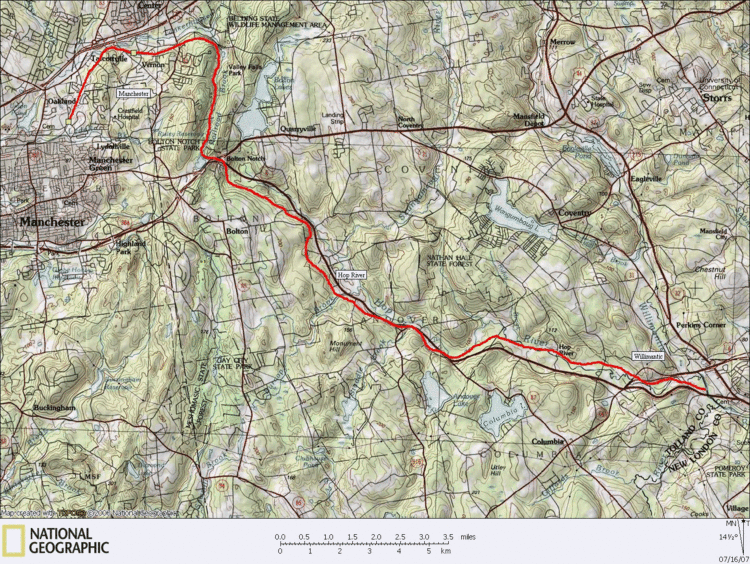
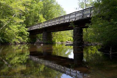
Hop River State Park Trail is a Connecticut rail trail that winds for 20.8 miles (33.5 km) eastward from Colonial Drive in the town of Manchester to the Air Line State Park Trail S. in the town of Windham. The trail parallels the Hop River for much of its length. It is owned and operated by the Connecticut Department of Energy and Environmental Protection, with upgrades and maintenance done by town forces and community volunteer groups in coordination with the state. The trail is used for hiking, biking, horseback riding, and cross-country skiing.
Contents
Hop river state park trail connecticut
History
The trail was originally part of the Hartford, Providence and Fishkill line from Hartford to Willimantic which was completed in 1849. Freight trains used the line through the 1960s. The last train ran on September 29, 1970, by which time the line was part of the bankrupt Penn Central. The Willimantic section of the trail was built in 2015, unlike the rest of the trail.
Description
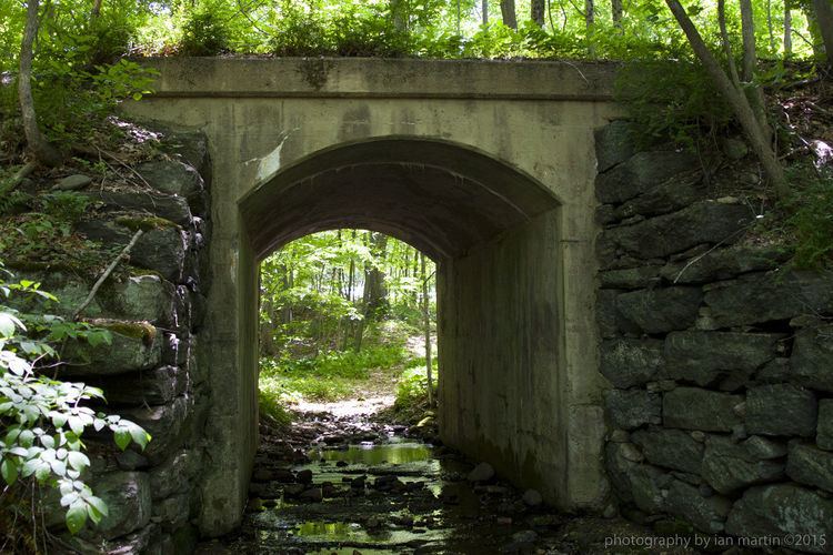
Though open to the public for its entire length, different sections of the trail are in different stages of development. Some sections are complete and have a finished, stone-dust surface and signage. Other sections have been cleared and had drainage work done, but still have a somewhat rough, unfinished surface that is not suitable for road bikes.
Until recently there had been many obstructions along the trail in the form of missing or unsafe bridges, especially on the eastern end of the trail in Coventry and Columbia. Most of these bridges have been repaired or replaced in the last couple of years by the state, towns, and local volunteers. There is now only one crossing (the eastern Hop River bridge in Columbia, CT ) that is incomplete and requires a short detour.
The following is a section by section description of the trail's current conditions, as of July 2014.
Colonial Road, Manchester to the western Hop River bridge at Columbia/Coventry town line: This long section of the trail, including the entire section of trail in the towns of Manchester, Vernon, Bolton and Andover has been completed. Drainage has been improved, signage installed, bridges built, parking lots built, and solid stone-dust surface installed. This is the best section of the trail to be completed so far and has long sections through parklands with no crossroads. The East Coast Greenway (ECG) section is from Bolton Notch East.
Western Hop River bridge at Columbia/Coventry town line to Kings Road, Coventry (all ECG): This section has been cleared and had drainage improvements, and has some finished surface installed. It is suitable for mountain bikes and horses, but a bit rough for street bikes.
Kings Road, Coventry to Flanders River Road, Columbia (all ECG): This section of trail is not passable due to a bridge over the Hop River that has not been renovated for trail use. The existing rail bridge is not safe to cross. There are no plans or funds to improve this bridge. Trail traffic can follow a short detour around this by following Kings Road to Flanders River Road and rejoining the trail after crossing the river on the road bridge.
Flanders River Road, Columbia to Willimantic River (all ECG): This section is open, but has not been developed or improved. It is passable by hikers and mountain bikes, but not street bikes. This is a very short section, as the Willimantic River bridge is not passable due to a deteriorated deck and is blocked off. Trail traffic must leave the rail bed at the former roadside picnic area and come out on parallel Route 66. The other side of the bridge is an active railroad line. The bridge was structurally evaluated by DOT, as noted in a Hartford Courant article (11/4 2014), but no funds are currently available to resurface it for trail use. The ECG trail to Willimantic is routed on-road along Route 66 across the river to the trail on the other side of the bridge.
Route 66, Windham/Columbia to Airline State Park Trail, Windham/Lebanon: This section opened in 2015, and the whole section is paved, and is on steep hill, on the eastern end This does not follow the original rail. It starts at the Windham side of the Willimantic River, immediately goes right under the Route 66 bridge Willimantic River and right on the border with Columbia, then follows the Willimantic River throughout the rest of the trail. The trail ends at the Airline Trail South in Willimantic. Turning right will bring you over the Willimantic River into Lebanon. To the original end of the railroad, turn left and continue to CT 32.
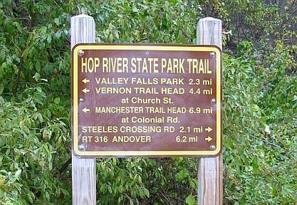
The trail crosses the following roads, providing access:
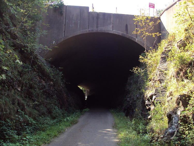
A stream restoration project with signage is located about 4 miles (6.4 km) from the Vernon trailhead. It is just north of where the trail goes under U.S. Route 44 at Bolton Notch in Bolton Notch State Park.
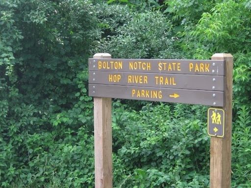
The eastern half of the trail at Bolton Notch State Park will connect to the Charter Oak Greenway going towards Manchester and Hartford. The eastern terminus of the trail is planned to eventually connect to the Air Line State Park Trail. The Charter Oak Greenway, Air Line State Park Trail, and the Hop River State Park Trail will be pieces of the East Coast Greenway (ECG), a trail linking major cities from Maine to Florida. The ECG in Connecticut runs from Rhode Island across to Hartford, down to New Haven and over to New York.