
Country United States NECTA Hartford Incorporated 1808 Elevation 119 m Local time Sunday 7:16 AM | State Connecticut Region Capitol Region Time zone EST (UTC-5) Zip code 06066 Population 29,179 (2010) | |
 | ||
Weather 2°C, Wind W at 6 km/h, 88% Humidity | ||
Vernon is a town in Tolland County, Connecticut, United States. The population was 29,179 at the 2010 census. Vernon contains the smaller villages of Rockville, Talcottville and Dobsonville.
Contents
- Map of Vernon CT USA
- History
- Geography
- Demographics
- Elementary schools
- Middle and secondary schools
- Notable people
- References
Map of Vernon, CT, USA
History
Vernon was incorporated in October 1808, from Bolton. Vernon was named after George Washington's Mount Vernon estate. Vernon contains the former city of Rockville, incorporated in January 1889. The Town of Vernon and city of Rockville consolidated as a town on July 1, 1965. Vernon also contains the smaller villages of Talcottville and Dobsonville.
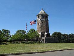
The New England Civil War Museum is located here.
Geography
According to the United States Census Bureau, the town has a total area of 18.1 square miles (47 km2), of which 17.7 square miles (46 km2) is land and 0.3 square miles (0.78 km2) (1.88%) is water.
Demographics
At the 2000 census, there were 28,063 people, 12,269 households and 7,275 families residing in the town. The population density was 1,582.8 per square mile (611.1/km²). There were 12,867 housing units at an average density of 725.7 per square mile (280.2/km²). The racial makeup of the town was 89.95% White, 3.99% African American, 0.24% Native American, 2.65% Asian, 0.04% Pacific Islander, 1.22% from other races, and 1.91% from two or more races. Hispanic or Latino of any race were 3.58% of the population.
There were 12,269 households of which 26.5% had children under the age of 18 living with them, 45.3% were married couples living together, 10.5% had a female householder with no husband present, and 40.7% were non-families. Of all households 33.0% were made up of individuals and 10.6% had someone living alone who was 65 years of age or older. The average household size was 2.26 and the average family size was 2.90.
22.1% of the population were under the age of 18, 7.7% from 18 to 24, 32.4% from 25 to 44, 23.9% from 45 to 64, and 13.9% who were 65 years of age or older. The median age was 38 years. For every 100 females there were 91.6 males. For every 100 females age 18 and over, there were 89.1 males.
The median household income was $47,816 and the median family income was $59,599. Males had a median income of $43,620 compared with $31,515 for females. The per capita income for the town was $25,150. About 4.1% of families and 5.9% of the population were below the poverty line, including 7.9% of those under age 18 and 6.1% of those age 65 or over.