
Prominence 431 m | Elevation 3,240 m | |
 | ||
First ascent 18 August 1852 by Franz Keil and guide, Paul Oblasser, and party Similar Glödis, Böses Weibl, Prijakt, Debantgrat, Keeskopf | ||
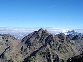
The Hochschober (3,240 m (AA)) is the mountain that gives its name to the Schober Group in the High Tauern, although the summit is only the fourth highest in the group. This may have arisen because the north face of the mountain is an impressive sight from Kals.
Contents
Map of Hochschober, 9951 Ainet, Austria
The easiest ascent is via the Hochschober Hut (2,322 m) from the south to the Staniskascharte notch (2,936 m) and along the western arête. There is another route of comparable difficulty from the east and along the upper part of the southeastern arête. The latter route may use the Lienzer Hut (1,977 m) as a base. Both routes are waymarked and now generally free of snow in the high summer, unlike earlier years, have easy klettersteig ratings (I) and are somewhat exposed in places. Another ascent option is the partly waymarked climb from the Schobertörl (2,898 m) along the northeastern arête, crossing the Kleinschober (3,125 m).