
Vehicle registration LZ Elevation 1,324 m Population 1,255 (1 Apr 2009) Postal code 9981 | Time zone CET (UTC+1) Website www.kals.at Area 180.5 km² Local time Saturday 7:45 AM Area code 04876 | |
 | ||
Weather 4°C, Wind NW at 13 km/h, 61% Humidity | ||
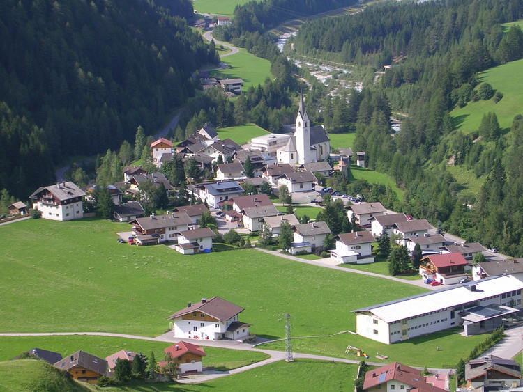
Kals am Großglockner is a town in the district of Lienz in the exclave of East Tirol in the Austrian state of Tyrol.
Contents
- Map of 9981 Kals am GroC39Fglockner Austria
- Geography
- Municipal arrangement
- History
- Sights
- Economy
- Twin cities
- References
Map of 9981 Kals am Gro%C3%9Fglockner, Austria
Geography
Kals is located in northern East Tirol, near the border to Salzburg and Carinthia. Located in the valleys of Kalser and Iseltals on the Kalserbach river, Kals is dominated by mountains, and the famous Großglockner mountain, the tallest mountain in all of Austria, is located partly in the municipality. Most of Kals is rugged and unusable (41.1%), with forests also prominent. Only 0.1% of the land is fields and pastures.
Municipal arrangement
Kals is divided into the following Katastralgemeinden: Unterpeischlach, Oberpeischlach, Staniska, Arnig, Lesach, Lana, Ködnitz, Glor-Berg, Großdorf, Unterburg, and Burg.
History
The Kalser valley might have been settled before the Paleolithic Age. Kals was first mentioned on 19 August 1197. A large copper mine was begun in the 16th century here. Kals was the starting point for the first ascent of Großglockner in 1853.
Sights
Economy
Kals is a large tourist center, with an average of about 100,000 visits in the summer. Of course, due to its high altitude it is also a skiing resort.