Prominence 410 m | Elevation 2,523 m | |
 | ||
Normal route via the Hocheis Cirque (Hocheiskar), unmarked Similar Großer Hundstod, Stadelhorn, Hochkalter, Seehorn, Großes Palfelhorn | ||
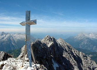
The Hocheisspitze is a 2,523 m high mountain in the Berchtesgaden Alps, over which the border between Germany and Austria runs. It is also the highest mountain in the eponymous Hocheis Group that belongs to the Hochkalter Massif.
Map of Hocheisspitze, Austria
The first reported ascent of the Hocheisspitze was by Hermann von Barth on 6 September 1868, although it is suspected that the mountain had been climbed much earlier.
The unmarked normal route runs over the Hocheis Cirque (Hocheiskar) up to the summit from the west. The top can also be reached over the sharp ridge between the Kammerlinghorn (2,484 m) and the Hocheisspitze. However, that requires sections of UIAA grade II-III to be climbed. In winter ski mountaineers undertake ski tours of the mountain.
References
Hocheisspitze Wikipedia(Text) CC BY-SA
