
Population 362 (2011) | Time zone EST (UTC-5) | |
 | ||
Website www.hiawathafirstnation.com | ||
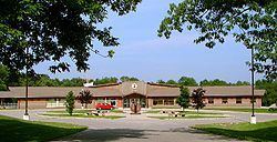
The Hiawatha First Nation is an Ojibway First Nations reserve located on the north shore of Rice Lake east of the Otonabee River in Ontario, Canada.
Contents
Map of Hiawatha First Nation, Hastings, ON, Canada
It is found in Otonabee Township approximately 30 kilometers south of Peterborough. The reserve consists of approximately 1,952 acres (7.90 km2) of land of which 1523 are under certificates of possession.
History
Indigenous peoples occupied this area for thousands of years before European contact. Nearly 2000 years ago, people of the Point Peninsula Complex built a series of earthen mounds for ceremonial, religious and burial purposes. Archaeological excavations have shown the people had sophisticated knowledge to build the massive earthworks. Nine mounds or burial places have been located at the south end of the park. Serpent Mounds Park includes an effigy mound, four to six feet high and nearly two hundred feet long, with a related egg-shaped mound by its mouth.
Population
In 2006 the population was 483, a 62.6% increase since 2001. There were 195 private dwellings.
Indian Reserves
Indian reserves assigned to the First Nation are: