
Time zone CET (UTC+1) Elevation 468 m Population 3,706 (2014) Local time Friday 2:28 PM | Demonym(s) Herrereños Postal code. 06670 Area 277 km² | |
 | ||
Weather 26°C, Wind S at 6 km/h, 33% Humidity | ||
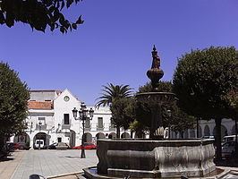
Herrera del Duque is a municipality located in the province of Badajoz, Extremadura, Spain. As of 2010, the municipality has a population of 3681 inhabitants.
Contents
Map of 06670 Herrera del Duque, Badajoz, Spain
The town is commanded by a 15th-16th-century fortress-castle. Other sights include the church of St. John the Baptist and the hermitage of Nuestra Señora de Consolación.
Villages
The municipality includes the village of Peloche, located at 8 km from the town, with a population of 235 inhabitants according to the 2009 census.
References
Herrera del Duque Wikipedia(Text) CC BY-SA