
Airport type Public 7/25 4,956 Code HHR Phone +1 310-349-1635 | Operator City of Hawthorne Elevation AMSL 66 ft / 20 m 4,956 1,511 Elevation 20 m | |
 | ||
Address 12101 Crenshaw Blvd #1, Hawthorne, CA 90250, USA | ||
Hawthorne Municipal Airport (IATA: HHR, ICAO: KHHR) (Jack Northrop Field) is a mile (2 km) east of Hawthorne, in Los Angeles County, California.
Contents
Facilities
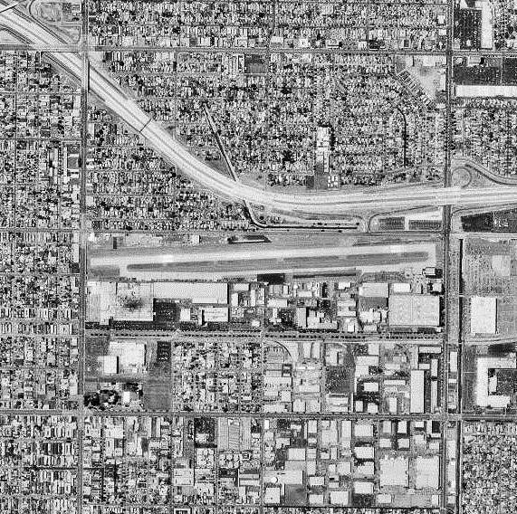
The airport covers 80 acres (32 ha); its one runway, 7/25, is 4,956 ft × 100 ft (1,511 m × 30 m) concrete.
History
The name Jack Northrop Field comes from the Northrop Aircraft Corporation founded by Jack Northrop, which for years designed, built and flew many classic airplanes, including Flying Wings, the P-61 Black Widow and the F-89 Scorpion night fighters, the F-5 Freedom Fighter, and the T-38 Talon jet trainer.
During World War II the airfield was used by the United States Army Air Forces Air Technical Service Command as an aircraft modification center and Air Transport Command to ferry new aircraft to operational units.
Space Exploration Technologies Corporation is currently headquartered at the southeast end of the airport.