
Country United States County Los Angeles Elevation 72 ft (22 m) Population 86,199 (2013) | State California Incorporated July 12, 1922 Local time Saturday 2:47 AM Area code 323 | |
 | ||
Weather 13°C, Wind S at 3 km/h, 97% Humidity Neighborhoods HollyGlen, Cypave, Holly Park | ||
Hawthorne is a city in southwestern Los Angeles County, California. The city at the 2010 census had a population of 84,293, up from 84,112 at the 2000 census and in 2013 a population of 86,199.
Contents
- Map of Hawthorne CA USA
- History
- Geography
- Climate
- 2010
- 2000
- Municipal government
- State and federal representation
- Infrastructure
- Primary and secondary schools
- Private schools
- Colleges and universities
- Media
- Economy
- Notable people
- References
Map of Hawthorne, CA, USA
History
The city was founded in 1905 as the "Hawthorne Improvement Company" by B.L. Harding and H.D. Lombard. Harding's daughter shared her birthday—July 4, American Independence Day—with New England author Nathaniel Hawthorne, and a decision was made to name the city after him.
Hawthorne was once a "whites only" settlement, commonly called a sundown town. During the 1930s, signs warned African-Americans to be out of Hawthorne by sundown.
Geography
According to the United States Census Bureau, the city has an area of 6.1 square miles (16 km2), over 99% of it land.
To the north of Hawthorne is the unincorporated community of Lennox and the city of Inglewood. To the east is the unincorporated community of Athens and the city of Gardena. To the south is the unincorporated community of El Camino Village, and the cities of Lawndale and Redondo Beach. Manhattan Beach is at the southwest corner of Hawthorne, and the city of El Segundo is to the west of Hawthorne. The unincorporated community of Del Aire is surrounded on three sides by the city of Hawthorne along western edge of Hawthorne.
The Century Freeway (Glenn Anderson Freeway, I-105) runs along the northern boundary of Hawthorne, with the LACMTA Green Line light rail line running down the center of the Century Freeway. The San Diego Freeway (I-405) runs along the western boundary of Hawthorne. Major east–west streets in Hawthorne include Rosecrans Ave., El Segundo Ave., and Imperial Highway. Major north–south street include Aviation Blvd., Inglewood Ave., Hawthorne Blvd., Prairie Ave., Crenshaw Blvd., and Van Ness Ave.
Hawthorne is five miles (8 km) from the Los Angeles International Airport.
Hawthorne comprises ZIP codes 90250 and 90251. It is in 310 area code, except for a small portion of northeastern Hawthorne, which is located in 323 area code.
Climate
Hawthorne, like the rest of the Los Angeles basin, is well known for its year-round Mediterranean climate:
Hawthorne has a Mediterranean climate or Dry-Summer Subtropical (Köppen climate classification Csb on the coast, Csa inland), enjoying plenty of sunshine throughout the year, with an average of 263 sunshine days and only 35 days with measurable precipitation annually.
The period of April through November is warm to hot and dry with average high temperatures of 71–79 °F (22–26 °C) and lows of 50–62 °F (10–17 °C). Due to the moderating effect of the ocean, temperatures are cooler than more inland areas of Los Angeles, where temperatures frequently exceed 90 °F (32 °C) and occasionally reach 100 °F (38 °C).
The Los Angeles area is also subject to the phenomena typical of a microclimate. As such, the temperatures can vary as much as 18 °F (10 °C) between inland areas and the coast, with a temperature gradient of over one degree per mile (1.6 km) from the coast inland. California has also a weather phenomenon called "June Gloom or May Grey", which sometimes brings overcast or foggy skies in the morning at the coast, but usually gives way to sunny skies by noon, during late spring and early summer.
The Los Angeles region averages 15 inches (385 mm) of precipitation annually, which mainly occurs during the winter and spring (November through April) with generally light rain showers, but sometimes as heavy rainfall and thunderstorms. On November 6, 1966 the first ever documented tornado touched down within the city's limits. It caused significant damage, it ran for about a half of a mile, from 132nd St. and Ramona Ave. to 140th St. and Ramona Ave. Snowfall is extremely rare but not impossible in the city basin.
2010
The 2010 United States Census reported that Hawthorne had a population of 84,293. The population density was 13,835.7 people per square mile (5,342.0/km²). The racial makeup of Hawthorne was 27,678 (32.8%) White (10.3% Non-Hispanic White), 23,385 (27.7%) African American, 565 (0.7%) Native American, 5,642 (6.7%) Asian, 974 (1.2%) Pacific Islander, 22,127 (26.3%) from other races, and 3,922 (4.7%) from two or more races. Hispanic or Latino of any race were 44,572 persons (52.9%).
The Census reported that 83,754 people (99.4% of the population) lived in households, 208 (0.2%) lived in non-institutionalized group quarters, and 331 (0.4%) were institutionalized.
There were 28,486 households, out of which 12,330 (43.3%) had children under the age of 18 living in them, 10,833 (38.0%) were opposite-sex married couples living together, 6,369 (22.4%) had a female householder with no husband present, 2,357 (8.3%) had a male householder with no wife present. There were 2,309 (8.1%) unmarried opposite-sex partnerships, and 191 (0.7%) same-sex married couples or partnerships. Of the households, 7,125 (25.0%) were made up of individuals and 1,430 (5.0%) had someone living alone who was 65 years of age or older. The average household size was 2.94. There were 19,559 families (68.7% of all households); the average family size was 3.54.
The population was spread out with 23,157 people (27.5%) under the age of 18, 9,487 people (11.3%) aged 18 to 24, 27,035 people (32.1%) aged 25 to 44, 18,395 people (21.8%) aged 45 to 64, and 6,219 people (7.4%) who were 65 years of age or older. The median age was 31.5 years. For every 100 females there were 93.2 males. For every 100 females age 18 and over, there were 89.6 males.
There were 29,869 housing units at an average density of 4,902.7 per square mile (1,892.9/km²), of which 7,623 (26.8%) were owner-occupied, and 20,863 (73.2%) were occupied by renters. The homeowner vacancy rate was 1.5%; the rental vacancy rate was 4.6%. 25,869 people (30.7% of the population) lived in owner-occupied housing units and 57,885 people (68.7%) lived in rental housing units.
During 2009–2013, Hawthorne had a median household income of $44,649, with 19.2% of the population living below the federal poverty line.
2000
As of the census of 2000, there were 84,112 people, 28,536 households, and 19,775 families residing in the city. The population density was 13,879.4 inhabitants per square mile (5,359.0/km²). There were 29,629 housing units at an average density of 4,889.1 per square mile (1,887.8/km²). The racial makeup of the city was 29.27% White, 39.02% Black or African American, 0.75% Native American, 7.73% Asian, 0.86% Pacific Islander, 24.16% from other races, and 5.22% from two or more races. 44.3% of the population were Hispanic or Latino of any race.
There were 28,536 households, out of which 43.7% included children under the age of 18, 38.6% were married couples living together, 23.5% had a female householder with no husband present, and 30.7% were non-families. Of all households 24.5% were made up of individuals and 4.5% had someone living alone who was 65 years of age or older. The average household size was 2.93 and the average family size was 3.50.
In the city, the population was spread out, with 31.7% under the age of 18, 11.3% from 18 to 24, 34.9% from 25 to 44, 16.1% from 45 to 64, and 6.1% who were 65 years of age or older. The median age was 29 years. For every 100 females there were 92.6 males. For every 100 females age 18 and over, there were 87.3 males.
The median income for a household in the city was $31,887, and the median income for a family was $35,149. Males had a median income of $29,481 versus $27,427 for females. The per capita income for the city was $15,022. About 18.4% of families and 20.3% of the population were below the poverty line, including 25.6% of those under age 18 and 9.0% of those age 65 or over.
Municipal government
According to the city’s most recent "Comprehensive Annual Financial Report," its various funds had $126.1 million in revenues, $113.2 million in expenditures, $220.2 million in total assets, $152.7 million in total liabilities, and $29.6 million in cash and investments. The structure of the management and coordination of city services is:
State and federal representation
In the California State Legislature, Hawthorne is in the 35th Senate District, represented by Democrat Steven Bradford, and in the 62nd Assembly District, represented by Democrat Autumn Burke.
In the United States House of Representatives, Hawthorne is in California's 43rd congressional district, represented by Democrat Maxine Waters.
Infrastructure
The Los Angeles County Department of Health Services operates the Curtis Tucker Health Center in Inglewood, serving Hawthorne.
The United States Postal Service Hawthorne Post Office is located at 12700 Inglewood Avenue.
Primary and secondary schools
Private schools
In addition Los Angeles County Office of Education operates Southwest Day (5th-12th grade).
Hawthorne Math and Science Academy is a charter high school in Hawthorne associated with the Hawthorne School District.
Colleges and universities
Media
The Hawthorne Press Tribune is the community newspaper for the City of Hawthorne.
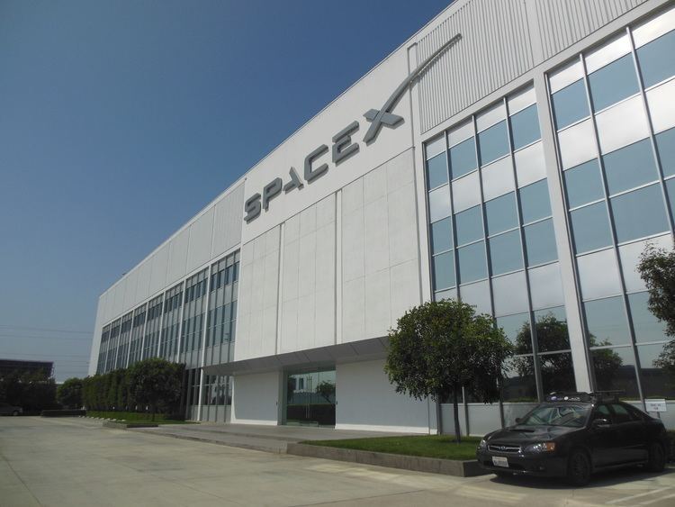
Economy
The following businesses are located in Hawthorne: