
Country United States Elevation 699 ft (213 m) Population 12,484 (2010) | GNIS feature ID 0453387 Local time Friday 3:14 AM | |
 | ||
Weather 1°C, Wind SE at 10 km/h, 48% Humidity Points of interest | ||
Harrison Township is one of twelve townships in Harrison County, Indiana, United States. As of the 2010 census, its population was 12,484 and it contained 5,282 housing units. Corydon, the county seat of Harrison County, is in Harrison Township.
Contents
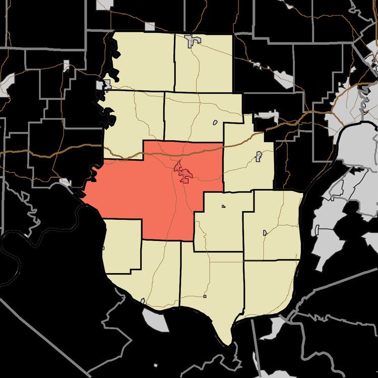
- Map of Harrison Township IN 47112 USA
- History
- Geography
- Cities and towns
- Unincorporated towns
- Adjacent townships
- Cemeteries
- Major highways
- References
Map of Harrison Township, IN 47112, USA
History
The township, like the county, is named for governor, general and ninth President William Henry Harrison. The majority of land in the township was in his possession in the first decade of the 19th century. He donated a parcel of land for the construction of Corydon and sold much of the rest of his land in the township by 1815 to the settlers who were rapidly occupying the countryside.
Corydon Battle Site was added to the National Register of Historic Places in 1979.
Geography
According to the 2010 census, the township has a total area of 101.58 square miles (263.1 km2), of which 101.33 square miles (262.4 km2) (or 99.75%) is land and 0.25 square miles (0.65 km2) (or 0.25%) is water. The streams of Blue River, Brush Heap Creek, Buck Creek, Hickman Branch, Little Indian Creek, Potato Run and Rock Creek run through this township.
Cities and towns
Unincorporated towns
(This list is based on USGS data and may include former settlements.)
Adjacent townships
Cemeteries
The township contains seven cemeteries: Cedar Hill, Conrad, Hillgrove, Jackson, Jordan, Shuck and Trout.