
Elevation 393 m | ||
 | ||
Similar Lake District, Hardknott Roman Fort, Honister Pass, Kirkstone Pass, Wast Water | ||
Driving hardknott pass in the lake district
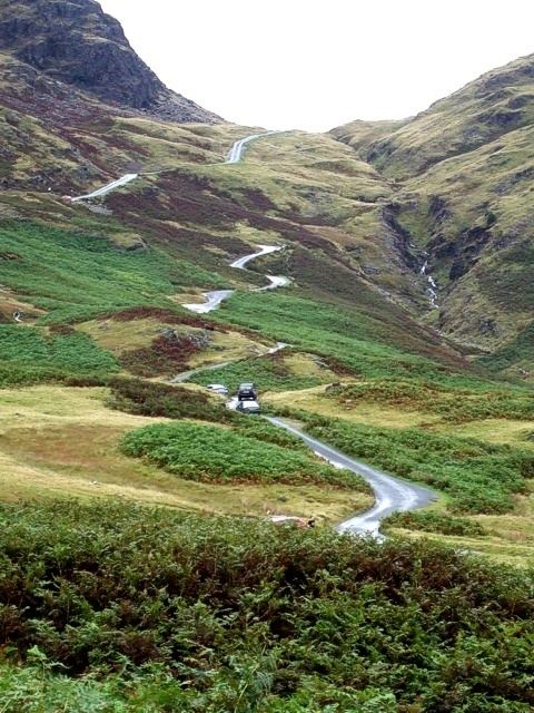
Hardknott Pass is a hill pass that carries a minor pathway between Eskdale and the Duddon Valley in the Lake District National Park, Cumbria, England. The road, which is the most direct route from the central Lake District to West Cumbria, shares the title of steepest road in England (the other is Rosedale Chimney Bank in North Yorkshire). It has a maximum gradient of 1 in 3 (about 33%).
Contents
- Driving hardknott pass in the lake district
- Hardknott pass a commentary by karen bailey with lashings of profanity
- EtymologyEdit
- GeographyEdit
- HistoryEdit
- References
Hardknott pass a commentary by karen bailey with lashings of profanity
EtymologyEdit
The pass takes its name from Hard Knott which is derived from the Old Norse harthr (hard) and knutr (craggy hill).
GeographyEdit
A single track road highway runs between Eskdale in the west to the edge of the neighbouring Wrynose Pass in the east. On the western side is Harter Fell and the remains of Hardknott Roman Fort (200 metres (660 ft) above sea level).
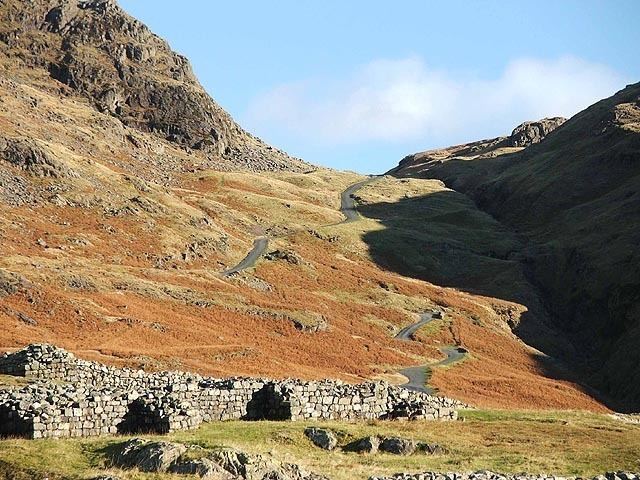
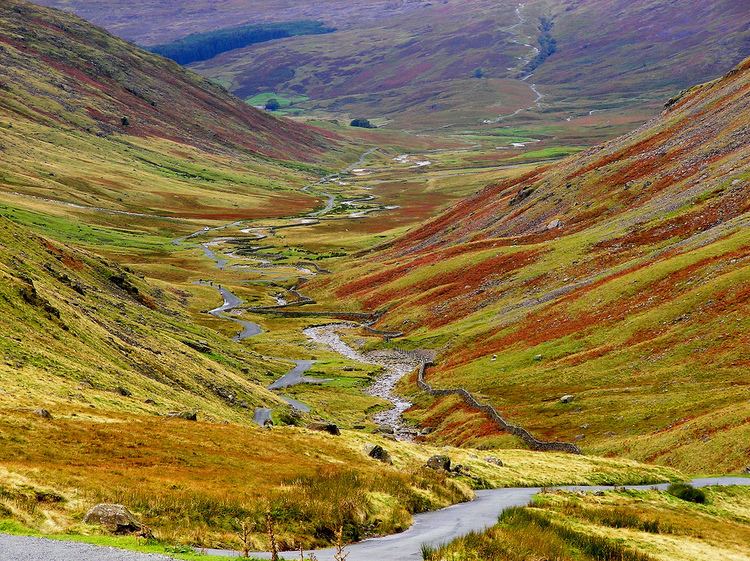
The Hardknott Pass stands at a maximum elevation of 393 m (1,289 ft). The Isle of Man in the Irish Sea can be seen on clear days. The road descends steeply at a gradient of 30% (1 in 3) into the Duddon Valley. At the eastern end of the pass is Cockley Beck farmhouse, it was built in the 1860s and currently owned by the National Trust. The route from Hardknott leads eastward towards the Wrynose Pass and Ambleside.
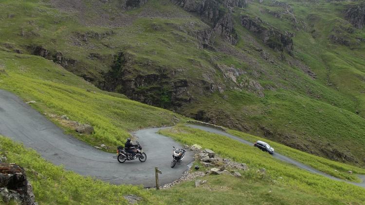
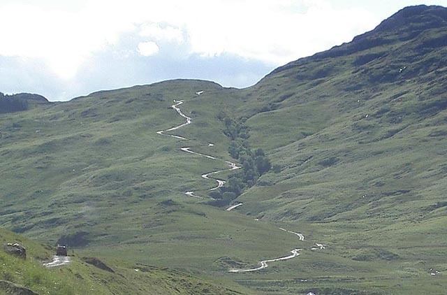
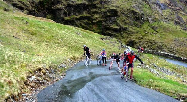
The pass is described as one of the most challenging roads in Britain. A series of hairpin bends make visibility difficult in various places. Traffic ascending the pass have priority as advised by the Highway Code. The pass is often closed in winter due to ice that makes the route impassable for vehicles. The challenging 1 in 3 gradients make the route popular with cyclists. It is part of the annual Fred Whitton Challenge, a 112-mile ride around the Lake District.
HistoryEdit
A road over the pass was built by the Romans around AD 110 to link the coastal fort and baths at Ravenglass with their garrisons at Ambleside and Kendal. The Romans called this road the Tenth Highway. The road fell into disrepair after the Romans left Britain in the early 5th century, although it remained as an unpaved packhorse route thereafter. The road was originally used entirely for military traffic, but following the Romans' retreat from Britain was used to transport lead and agricultural goods. By the early Middle Ages, the road was known as the Waingate ("cart road") or Wainscarth ("cart pass"): there is an 1138 record of a party of monks traversing it in an oxcart.
In the 1880s an association of hoteliers, the English Lake District Association, financed improvements to the road in the hope of encouraging tourist excursions by carriage; by 1891 the scheme was judged to be "not the success that was anticipated". Nevertheless, the route had some popularity with cyclists and early motorists, with the Cyclists' Touring Club 1911 Guide to North-West England describing the old coach road as "difficult going West, cruel coming East". The first motor vehicles were taken over the Hardknott and Wrynose passes, from the Eskdale side, in 1913.
In 1936, the Cumberland Highways Committee considered, and rejected, a proposal to make the pass more accessible to motors by laying down a new road surface and making other improvements. However, during the Second World War the War Office used the area for tank training completely destroying the existing road surface. After the war the wartime damage was repaired and tarmacked. A decade after the local government had rejected opening the highway to vehicles, the war's legacy had inadvertently created a direct route between Ambleside and Eskdale for the first time.
The courses of the Roman and modern roads are not identical. The Roman highway - on the western side - is to the north of the modern road and to the south on the eastern side of the pass.