Population 304 (2011) Civil parish Eskdale Dialling code 019467 | OS grid reference NY1700 Sovereign state United Kingdom UK parliament constituency Copeland | |
 | ||
Points of interest Hardknott Roman Fort, Bowfell, Stanley Ghyll Waterfall, Sca Fell, Eskdale Mill | ||
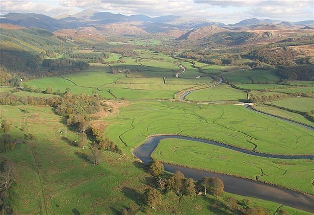
Eskdale is a glacial valley and civil parish in the western Lake District National Park in Cumbria, England. It forms part of the Borough of Copeland, and, in 2001 had a population of 264, increasing to 304 at the 2011 Census. One of the Lake District's most popular tourist attractions, the Ravenglass and Eskdale Railway, runs through the valley, though along with other western valleys of the Lake District, Eskdale is notably quieter during the high summer season than the more accessible eastern areas.
Contents
- Map of Eskdale UK
- Topography
- Historical districts
- June 2010 shootings
- Proposed nuclear waste facility
- References
Map of Eskdale, UK
Topography
The River Esk flows through the valley to its estuary at Ravenglass. The valley is notable in being one of few major valleys in the Lake District not to have its own lake, although several tarns are perched above the valley sides.
The main access to the valley is from the western end; however, there is also a steep pass with a motor road leading out of the valley to the east over Hardknott Pass, as well as a road with beautiful views leading southwards over Birker Fell to the village of Ulpha in the Duddon Valley.
Alfred Wainwright in his guide "Walks from Ratty" describes Eskdale as "One of the loveliest of Lakeland's valleys, descends from the highest and wildest mountains in the district to the Sands of Ravenglass in a swift transition from bleak and craggy ridges to verdant woodlands and pastures watered by a charming river." Upper Eskdale is a remote wilderness surrounded by Sca Fell, Scafell Pike, Ill Crag, Esk Pike, Bow Fell and Crinkle Crags; the Woolpack walk takes in this classic horseshoe.
Historical districts
The former Eskdale ward of north eastern Cumberland was named after the River Esk in the Scottish Borders, whereas the valley described in this article was located in the former ward of Allerdale Above Derwent which is the present-day local council district of Copeland.
June 2010 shootings
The area became one of the locations involved in a killing spree perpetrated by 52-year-old taxi driver Derrick Bird, who shot and killed twelve people and wounded eleven others. Several of the wounded victims were shot in Eskdale and the surrounding area.
Proposed nuclear waste facility
In June 2012, it became clear that Eskdale (specifically the Eskdale granite formed in the Ordovician Period around 450 million years ago) has been identified as a potential site for a Geological Disposal Facility for the UK's high level nuclear waste. Two other sites have also been identified - Ennerdale and the Solway Plain. Eskdale was not named by the Managing Radioactive Waste Safely (MRWS) Partnership, rather they referred to the 'granitic rocks forming part of The Lake District Batholith'. These are the Ennerdale and Eskdale granites. This was in (publicly available) document 285 of the West Cumbria MRWS in a report written by Dr Dearlove, the consultant geologist recruited by MRWS.
