
- summer (DST) CEST (UTC+2) Area 14.38 km² | Elevation 207 m Local time Thursday 5:58 AM | |
 | ||
Weather -2°C, Wind SW at 5 km/h, 84% Humidity | ||
Hanu ovce nad top ou mal ve k mesto
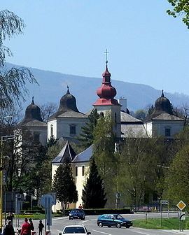
Hanušovce nad Topľou is a town in the Vranov nad Topľou District, Prešov Region in eastern Slovakia, near the Topľa river.
Contents
- Hanu ovce nad top ou mal ve k mesto
- Map of 094 31 HanuC5A1ovce nad TopC4BEou Slovakia
- Hanu ovce nad top ou
- History
- Geography
- Demographics
- Twin towns Sister cities
- References
Map of 094 31 Hanu%C5%A1ovce nad Top%C4%BEou, Slovakia
Hanu ovce nad top ou
History
The first written record about the town was in 1332 under name Hanusa.
Geography
Hanušovce nad Topľou lies at an altitude of 207 metres (679 ft) above sea level and covers an area of 14.973 square kilometres (5.8 sq mi). It is located in the Beskidian Piedmont between the ranges of Slanské vrchy and Ondavská vrchovina, 22 kilometres (14 mi) north-west from the district seat Vranov nad Topľou and 25 kilometres (16 mi) east of Prešov.
Demographics
According to the 2001 census, the town had 3,582 inhabitants. 85.01% of inhabitants were Slovaks, 14.27% Roma and 0.20% Ukrainians. The religious makeup was 53.41% Roman Catholics, 36.63% Lutherans, 5.19% Greek Catholics and 1.31% people with no religious affiliation.
According to the 2011 census, the town had 3,741 inhabitants. 2,961 of inhabitants were Slovaks, 641 Roma and 139 others and unspecified.
Twin towns — Sister cities
Hanušovce nad Topľou is twinned with: