
Topo map Garfield | Elevation 3,721 m | |
 | ||
Similar Alpine Tunnel, Rocky Mountains, Mount Antero, Cottonwood Pass, Mosquito Pass | ||
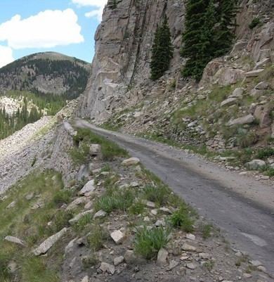
Hancock Pass, elevation 12,208 ft (3,721 m), is a high mountain pass on the Continental Divide in western Colorado. The pass is on the border between Chaffee and Gunnison counties and between the Gunnison and San Isabel national forests.
Map of Hancock Pass, Colorado 81201, USA
The road over the pass is of moderate difficulty and is very rocky and slow going.
References
Hancock Pass Wikipedia(Text) CC BY-SA