
Palestine grid 148/174 Name meaning "pregnant" | ||
 | ||
Weather 17°C, Wind SW at 21 km/h, 65% Humidity | ||
Hableh (Arabic: حبله, also transliterated Hable, Habla, Hablah, Hibla, Hiblah; Hebrew: חבלה) is a Palestinian village located in the Qalqilya Governorate in the northwestern West Bank. According to the Palestinian Central Bureau of Statistics (PCBS) census, the town had a population of 6,016 in 2007.
Contents
- Map of Hable
- Location
- History
- Ottoman era
- British Mandate era
- 1948 1967
- Post 1967
- Separation barrier
- References
Map of Hable
Location
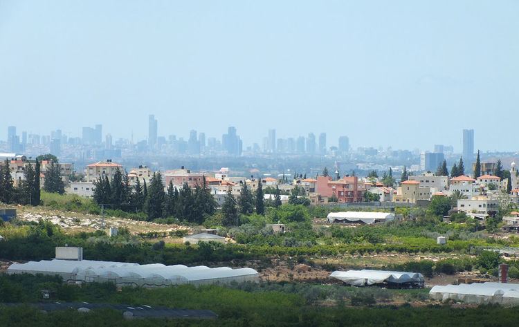
Habla is located just east of the Green Line, about 1-mile (1.6 km) southeast of the Palestinian town of Qalqilya as the crow flies, in the West Bank.
History
About a dozen tombs, with loculi have been found, together with cisterns. The type of tombs indicate that they are Christian. Ancient remains of a mosque and houses have been found in the village.
Ottoman era
During the period of Ottoman rule over Palestine, Hableh appeared in Ottoman tax registers in 1596, where it is listed as forming part of the Nahiya of Jabal Qubal in the Liwa of Nablus. It had a population of 41 Muslim households. Pierre Jacotin called the village Hableh on his map in 1799.
Edward Robinson and Eli Smith visited Hableh in the mid-19th century and describe it as being situated along the southern side of a low rocky ridge overlooking a plain on which could be seen the villages of Kilkilieh, Kfer Saba, Jiljulieh, and Ras al Ain. Camping on the ground to the south of the village and north of a wali on a low rocky hill, Robinson and Smith found themselves surrounded by cisterns dug into the rock. Most of these had round openings, some with one or two steps by which one could descend into them to draw water. All appeared to be ancient, and only one was still in use. There was also a sepulcher with an arched vault and an ancient wine press made up of two vats, one shallower and smaller than the other in which grapes would have been trodden with the juice going down through a hole to the larger, deeper vat directly adjacent and slightly below.
Victor Guérin, who visited Hableh in 1870, said it contained 800 inhabitants, and that a few of the houses, but principally the village mosque, were built using large stones of apparent antiquity. He too noted the presence of ancient rock-cut formations around the village. In 1882, the Palestine Exploration Fund's Survey of Western Palestine described Hableh as a "village of moderate size, evidently an ancient site, surrounded with cisterns and tombs. The houses are principally of stone. The water supply from cisterns."
British Mandate era
In the wake of World War I, British military governors were established in Palestine's major cities and the deputy for the governor in Nablus was stationed in Habla. During the mandate period, Hableh formed part of the Tulkarm Subdistrict. In the 1922 census of Palestine conducted by the British Mandate authorities, Hableh had a population of 271, all Muslims, increasing in the 1931 census to 397, still all Muslims, in a total of 86 houses.
By the end of the mandate period, in 1945, the population had increased to 580. The village lands covered an area of 10,903 dunams: 8,391 of which were owned by Arabs, 570 by Jews, and 1,942 of which were public lands. A total of 28 dunams were for citrus and bananas, 169 dunams for plantations and irrigable land, 6,847 for cereals, while 15 dunams were classified as built-up areas.
1948-1967
In the wake of the 1948 Arab–Israeli War, and after the 1949 Armistice Agreements, Hableh came under Jordanian rule.
Post-1967
After the Six-Day War in 1967, Hableh has been under Israeli occupation.
Inhabitants of Habla were among the 10,000 Palestinians displaced as a result of the 1967 war. According to Nur Masalha, Israeli forces evicted civilians and deliberately destroyed Habla among a number of other villages during the war (such as Imwas, Yalu, Bayt Nuba, Bayt Marsam, Bayt 'Awa, al-Burj, and Jiftlik).
Separation barrier
According to a report in The Jerusalem Times on January 24, 1996, Israeli bulldozers began levelling 1.7 square kilometers (0.66 sq mi) land in Hiblah belonging to its Palestinian residents in order to build an electronic wall that would separate the towns of Tulkarm and Kalkiliya from the Green Line. That same day, a resident of Hiblah was shot in the head by Israeli soldiers who fired at Palestinians trying to stop the bulldozers. In February of the same year, it was reported that the security fence being built on Hibla's land would be 22 kilometers (14 mi) long and would separate the village from the Israeli settlement of Matti.
The construction of the Israeli West Bank barrier to the north of the village in the first decade of the 21st century changed the life of Habla's inhabitants. Palestinian labourers line up every day before 5am at gate no. 1393 in the barbed wire fence surrounding Habla. Manned by soldiers from the Israel Defense Forces (IDF). They wait approximately two hours so as to enter the seam zone, a closed military zone, where they seek to tend to land that they own there or in nearby Qalqilya or to work in these areas as manual labourers.
All those entering the seam zone must have a valid "pass-permit" that allows them to leave and enter for work which is issued by the Israeli military authorities. Those with the proper pass permits who wish to access Qalqilya can drive 12 miles (19 km) around the barrier, through multiple checkpoints. Alternatively, they may use an underground tunnel that was built in 2004 to connect Habla to Qalqilya.