
Established 1797 Demonym(s) Guantanamero/ra Area 741.4 km² Local time Saturday 2:40 AM | Elevation 46 m (151 ft) Time zone EST (UTC-5) Population 217,365 (2012) Postal code 95100 | |
 | ||
Weather 22°C, Wind NW at 10 km/h, 89% Humidity | ||
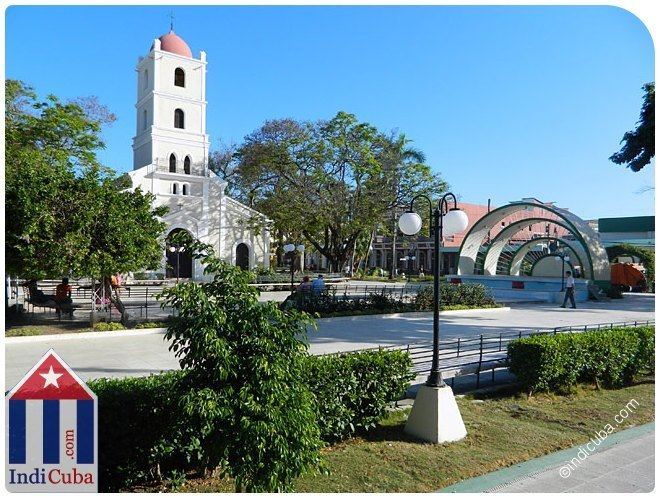
Guantánamo is a municipality and city in southeast Cuba and capital of Guantánamo Province.
Contents
- Map of Guantanamo Cuba
- History
- Overview
- United States Naval Base
- Demographics
- Famous Guantanameros
- Transport
- The song Guantanamera
- References
Map of Guantanamo, Cuba
Guantánamo is served by the Caimanera port near the site of a U.S. naval base. The area produces sugarcane and cotton wool. These are traditional parts of the economy.
History
The city was founded in 1797 in the area of a farm named Santa Catalina. The toponym "Guantánamo" means, in Taíno language, "land between the rivers".
Overview
The municipality is mountainous in the north, at Humboldt National Park, where it overlays the Sierra Maestra (mountains), and borders the Windward Passage of the Caribbean Sea in the south. It is crossed by the Bano, Guantánamo, Yateras, Guaso, San Andrés and Sabanalamar rivers. The city is spread with a square plan and is crossed in the middle by the Carretera Central highway. Guantánamo Bay is a natural harbour south of it.
The municipality borders with El Salvador, Niceto Pérez, Caimanera, Yateras, Manuel Tames and Sagua de Tánamo; this one in Holguín Province. It counts the villages of Argeo Martínez, Arroyo Hondo, Glorieta, Las Lajas and Paraguay.
Prior to 1976 it was divided into the barrios and villages Arroyo Hondo, Baitiquirí, Bano, Bayate, Caimanera, Camarones, Caridad, Corralillo, Cuatro Caminos, Filipinas, Glorieta, Gobierno, Guaso, Hospital, Indios, Isleta, Jaibo Abajo, Las Lajas, Macurijes, Mercado, Ocujal, Parroquia, Palma de San Juan, Rastro, Tiguabos and Vínculo. After 1976 reform part of municipal territory was split in the municipalities of El Salvador, Niceto Pérez, Caimanera and San Antonio del Sur.
United States Naval Base
About 15 km away from the city lies the Guantánamo Bay, a superior natural harbor which has been utilized by the United States since 1898, when it was captured from Spain in the Battle of Guantánamo Bay. In 1903 Cuba leased it to the U.S. under duress as it had committed to in the Cuban–American Treaty of Relations, and remains the site of a US Navy base, as well as the Guantanamo Bay detention camp.
Demographics
In 2004, the municipality of Guantánamo had a population of 244,603. With a total area of 741 km2 (286 sq mi), it has a population density of 330.1/km2 (855/sq mi).
Famous Guantanameros
Notable natives of Guantánamo include athletes Joel Casamayor, Erislandy Lara, Yuriorkis Gamboa, Yumileidi Cumbá, Jaime Jefferson, Yargelis Savigne, Dayron Robles, Luis Delís, Cuban-American gymnast Annia Hatch, and cosmonaut Arnaldo Tamayo Méndez.
Transport
The city is served by the Carretera Central highway, and is the western terminus of the A1 motorway, that is mainly under construction and will link Guantánamo with Havana. The city airport "Mariana Grajales" is located near the villages of Las Lajas and Paraguay.
The song "Guantanamera"
"Guantanamera" (Spanish: "from Guantánamo [feminine]", thus "woman from Guantánamo") is perhaps the best known Cuban song and that country's most noted patriotic song. In 1966, a version by American vocal group The Sandpipers, based on an arrangement by Pete Seeger, became an international hit.