
Country Canada Settled 1953 Elevation 41 m Population 129 (2016) Number of airports 1 | Time zone EST (UTC-5) Area 332.7 km² Local time Friday 10:54 AM | |
 | ||
Weather -41°C, Wind NE at 8 km/h, 66% Humidity | ||
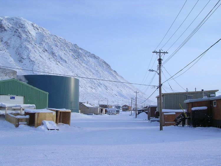
Grise fiord nunavut canada s most northern community in 1987
Grise Fiord, (Inuktitut: Aujuittuq, "place that never thaws"; Inuktitut syllabics: ᐊᐅᔪᐃᑦᑐᖅ) is an Inuit hamlet in the Qikiqtaaluk Region in the territory of Nunavut, Canada. Despite its low population (129 residents as of the Canada 2016 Census), it is the largest community on Ellesmere Island. It is also one of the coldest inhabited places in the world, with an average yearly temperature of −16.5 °C (2.3 °F).
Contents
- Grise fiord nunavut canada s most northern community in 1987
- Map of Grise Fiord NU Canada
- Geography
- Naming
- Living conditions
- Transportation
- Economy development and sustainability
- Crime and safety
- Settlement
- Telephone network
- References
Map of Grise Fiord, NU, Canada
Geography
Located at the southern tip of Ellesmere Island, Grise Fiord is one of three permanent settlements on the island. Grise Fiord lies 1,160 km (720 mi) north of the Arctic Circle.
Grise Fiord is the northernmost civilian settlement in Canada, but Environment Canada has a permanent weather station, Eureka, and at Alert there is a permanent Canadian Forces Base (CFS Alert) and weather station, that lie further north on the island.
Grise Fiord cradles the Arctic Cordillera mountain range.
Naming
Grise Fiord means "pig inlet" in Norwegian and was named by Otto Sverdrup from Norway during an expedition around 1900. He thought the walrus in the area sounded like pigs. Grise Fiord's Inuktitut name is Aujuittuq which means "place that never thaws."
Living conditions
The population of Grise Fiord is declining, and consists of around 129 permanent residents, a decrease of -0.8% from the 2011 census. The houses are wooden and built on platforms to cope with the freezing and thawing of the permafrost. Hunting is still an important part of the lifestyle of the mostly Inuit population. Quota systems allow the villagers to supply many of their needs from populations of seals, walruses, narwhal and beluga whales, polar bears and muskox. Ecotourism is developing as people come to see the northern wildlife found on Ellesmere and surrounding islands.
Transportation
There are no connecting roads on Ellesmere Island, so Grise Fiord is connected to the rest of the world by a small airstrip (Grise Fiord Airport) 1,670 feet (510 m) in length. It is one of the most difficult approaches for aircraft, and it is cautioned that only very experienced pilots and DHC-6 Twin Otter aircraft attempt the approach. For local travel needs, the villagers use all-terrain vehicles in the summer and snowmobiles in the winter. But during the winter months travel is limited to the town site and a small patch of land to the east called Nuvuk, due to mountains and ice fields that cut the town off from the rest of the island. Small boats are used in summer to reach hunting grounds, or hunting sea mammals on the ocean. Once a year large ships (sealift) arrive with supplies and fuel.
Economy, development, and sustainability
There is a local co-operative which is the main place to purchase supplies. There are local guide and outfitting operations which are an important source of income for many families. Carving and traditional crafts and clothing are also important sources of income. The economy is a subsistence-based one due to the extreme location. Grise Fiord is the most isolated true community anywhere on the planet. Between rising/stormier ocean, and falling rock/avalanche potential from mountains, there is no room for growth.
Crime and safety
A Simon Fraser University study of Royal Canadian Mounted Police (RCMP) activity in the Baffin Region states that Grise Fiord had the lowest rate of criminal offences of all communities looked at in 1992, and cites a 1994 Statistics Canada survey that gives the highest perception of personal safety.
Settlement
The settlement (and Resolute) was created by the Canadian government in 1953, partly to assert sovereignty in the High Arctic during the Cold War. Eight Inuit families from Inukjuak, Quebec (on the Ungava Peninsula) were relocated after being promised homes and game to hunt, but the relocated people discovered no buildings and very little familiar wildlife. They were told that they would be returned home after a year if they wished, but this offer was later withdrawn as it would damage Canada's claims to sovereignty in the area and the Inuit were forced to stay. Eventually, the Inuit learned the local beluga whale migration routes and were able to survive in the area, hunting over a range of 18,000 km2 (6,900 sq mi) each year.
In 1993, the Canadian government held hearings to investigate the relocation program. The Royal Commission on Aboriginal Peoples issued a report entitled The High Arctic Relocation: A Report on the 1953-55 Relocation, recommending a settlement. The government paid $10 million CAD to the survivors and their families, and gave a formal apology in 2010.
In 2009, Looty Pijamini was commissioned by the Canadian Government to design a monument in memory of the relocation. Depicting a sad-looking woman with a young boy and a husky, the monument was unveiled by John Duncan, Minister of Indian Affairs and Northern Development and Federal Interlocutor for Métis and Non-Status Indians, on September 10, 2010.
Telephone network
In 1970, Bell Canada established what was then the world's most northerly telephone exchange (operated since 1992 by Northwestel). It is in the 867 area code (formerly 819, before October 1997) with its only exchange code of 980.