
Topo map OS Explorer OL7 Prominence 41 m | OS grid NY497072 Elevation 638 m | |
 | ||
Similar | ||
Lake district the far eastern fells grey crag tarn crag kentmere pike shipman knotts
Grey Crag is a fell in the English Lake District. It stands to the east of Longsleddale in the Far Eastern Fells. There is another fell named Gray Crag in the Lake District near Hartsop.
Contents
- Lake district the far eastern fells grey crag tarn crag kentmere pike shipman knotts
- Map of Grey Crag Kendal UK
- Grey crag barn
- Topography
- Summit
- Ascents
- Haweswater aqueduct
- References
Map of Grey Crag, Kendal, UK
Grey crag barn
Topography
North of Sadgill, the valley of Longsleddale narrows considerably with walls of crag on either side. Grey Crag is the first fell encountered above the eastern side, although the top is not visible from below. What is in sight is a short flat topped spur at a height of around 1,600 ft which juts out southwards from the body of the fell. This is Great Howe, and its steep flanks provide the east wall of Longsleddale, together with further outcrops above the side valley of Stockdale. Grey Crag proper is a second tier of crags, set back from Great Howe and just below the summit, thus giving its name to the entire fell.
Grey Crag is the focus of an extensive ridge system stretching out eastwards to the distant Lune and Eden Valleys. Grey Crag lies on the main watershed of the Cumbrian hills, its runoff reaching the sea at both the Solway Firth and Morecambe Bay. The long east ridges have a moorland character and provide easy walking in quiet conditions. The principal tops are Ancrow Brow (1,820 ft), White Howe (1,738 ft), Lords Seat (1,719 ft) and Great Yarlside (1,950 ft). These ridges encompass the valleys of Bannisdale, Crookdale, Wet Sleddale, Borrowdale and Wasdale, the latter two of which should not be confused with their more famous Lakeland counterparts.
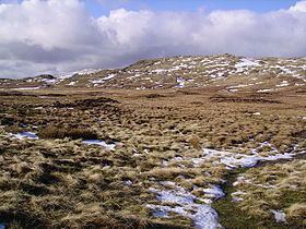
To the north of the summit is a marshy depression, containing Greycrag Tarn. This is a series of small pools in the bed of a larger historic waterbody. Beyond the tarn is Grey Crag's sister fell, Tarn Crag.
Summit
The top of the fell is a short ridge with the summit at the south west end. Half a mile to the north east is a second top, Harrop Pike, only marginally lower at 2,089 ft (637 m.). A fence joins the summit ridge about halfway along from the direction of Tarn Crag, and then makes for Harrop Pike. The true top has a small cairn, while Harrop Pike sports a more impressive columnar beacon. The views east and south are expansive while westwards the Coniston and Scafell groups can be seen.
Ascents
Grey Crag can be climbed from Longsleddale via Great Howe, or from the vicinity of the A6 (Shap) road via any of the long eastern ridges mentioned above.
Haweswater aqueduct
Great Howe carries the remains of a surveying pillar on its eastern flank. This unusual stone and concrete construction is cleft at the top to provide a sight line and was originally surrounded by a wooden frame, now decayed. This is one of four such pillars built during the construction of the Haweswater aqueduct. Below Branstree, Tarn Crag and Great Howe is the first section of the pipeline carrying water from the reservoir toward Manchester. The tunnel, some 1,000 ft below Great Howe, required 250 tons of gelignite for blasting, and when constructed in the 1930s was the longest such pipeline in Britain. It emerges into Longsleddale below the southern end of Great Howe, where the spoil can still be seen.