
Type Highway Route number(s) B100 Length 243 km | Opened 1932 | |
 | ||
Major cities Apollo Bay, Lorne, Torquay, Port Campbell, Anglesea, Wye River, Aireys Inlet, Peterborough, Lavers Hill, Kennett River Via Anglesea, Aireys Inlet, Lorne, Wye River, Kennett River, Victoria, Apollo Bay, Lavers Hill, Port Campbell, Peterborough Similar The Twelve Apostles, Great Otway National, Loch Ard Gorge, London Arch, Grampians National Park | ||
Great ocean road victoria australia vacations tours
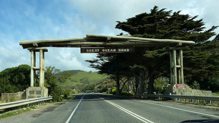
The Great Ocean Road is an Australian National Heritage listed 243 kilometres (151 mi) stretch of road along the south-eastern coast of Australia between the Victorian cities of Torquay and Allansford. Built by returned soldiers between 1919 and 1932 and dedicated to soldiers killed during World War I, the road is the world's largest war memorial. Winding through varying terrain along the coast and providing access to several prominent landmarks, including the Twelve Apostles limestone stack formations, the road is an important tourist attraction in the region.
Contents
- Great ocean road victoria australia vacations tours
- Map of Great Ocean Rd Victoria Australia
- General
- Great Ocean Road Marathon
- Cadel Evans Great Ocean Road Race
- History
- Construction effort
- Completion and early usage
- Great Ocean Walk
- References
Map of Great Ocean Rd, Victoria, Australia
General
The Great Ocean Road starts at Torquay and travels 244 kilometres westward to finish at Allansford near Warrnambool, the largest city along the road. The road is two lane (one in each direction), and is covered by a speed limit changing between 50 kilometres per hour and 100 kilometres per hour.
The road is considered a tourist attraction in the area, in which much of the road hugs coastline affectionately known as the Surf Coast between Torquay and Cape Otway and the Shipwreck Coast further west of Cape Otway, providing visibility of Bass Strait and the Southern Ocean. The road traverses rainforests, as well as beaches and cliffs composed of limestone and sandstone, which is susceptible to erosion. The road travels via Anglesea, Lorne, Apollo Bay, and Port Campbell, the latter being notable for its natural limestone and sandstone rock formations including Loch Ard Gorge, The Grotto, London Arch (formerly London Bridge) and The Twelve Apostles. At the stretch of the Great Ocean Road nearer to Geelong, the road meanders along the coast, with tall, almost-vertical cliffs on the other side of it. Road signs put up along the road warn motorists of possible rockfalls, which have occurred before.
The city of Geelong, close to Torquay, experiences great benefit from Australian and international visitors to the road; with Geelong Otway Tourism affirming it as an invaluable asset. The Royal Automobile Club of Victoria (RACV) listed the road as the state's top tourism experience in its Victoria 101 survey, based on spots recommended by members and the public on what they would recommend to visitors. However, according to a survey performed by the Surf Coast Shire, residents have expressed concern that there are not enough safe crossings along the road.
Great Ocean Road Marathon
A 45 kilometre section of the Great Ocean Road, between Lorne and Apollo Bay, is the location of the annual "Great Ocean Road Marathon". First run in 2005, the current marathon record of two hours, 27 minutes and 42 seconds was set in 2011 by James Kipkelwon of Kenya who also won the event in 2012.
Cadel Evans Great Ocean Road Race
In July 2014 former World Road Cycling Champion and Tour de France winner Cadel Evans announced that the Great Ocean Road would play host to the Cadel Evans Great Ocean Road Race in early 2015, including elite races for men and women and a mass participation People's Ride.
History
The Great Ocean Road was first planned towards the end of the first world war, when chairman of the Country Roads Board, William Calder, asked the State War Council for funds to be provided for returned soldiers to work on roads in sparsely populated areas in the Western District. By the time of World War I, the rugged south-west coast of Victoria was accessible only by sea or rough bush track. Besides being dedicated as a memorial, it was also envisaged that the road would connect isolated settlements on the coast, and become a vital transport link for the timber industry and tourism.
Surveying for the road, tentatively titled the South Coast Road, started in 1918 – with the road suggested to travel from Barwon Heads, follow the coast west around Cape Otway, and end near Warrnambool. In 1918, the Great Ocean Road Trust was formed as a private company, under the helm of president Howard Hitchcock. The company managed to secure £81,000 in capital from private subscription and borrowing, with Hitchcock himself contributing £3000. Money would be repaid by charging drivers a toll until the debt was cleared, and the road would then be gifted to the state.
Construction effort
Construction on the road began on 19 September 1919, built by approximately 3,000 returned servicemen as a war memorial for fellow servicemen who had been killed in World War I. An advance survey team progressed through dense wilderness at approximately 3 kilometres a month. Construction was done by hand; using explosives, pick and shovel, wheel barrows, and some small machinery, and was at times perilous, with several workers killed on the job; the final sections along steep coastal mountains being the most difficult to work on. Anecdotal evidence from ABC archives in 1982 suggested workers would rest detonators on their knees during travel, as it was the softest ride for them.
The soldiers were paid 10 shillings and sixpence for eight hours per day, also working a half-day on Saturdays. They used tents for accommodation throughout, and made use of a communal dining marquee and kitchen; food costing up to 10 shillings a week. Despite the difficulty involved in constructing the road, the workers had access to a piano, gramophone, games, newspapers and magazines at the camps. Additionally, in 1924, the steamboat Casino became stranded near Cape Patton after hitting a reef, forcing it to jettison 500 barrels of beer and 120 cases of spirits. The workers obtained the cargo, resulting in an unscheduled two-week-long drinking break.
Completion and early usage
On 18 March 1922 the section from Eastern View to Lorne was officially opened with celebrations. However it was then closed from 10 May 1922 for further work; opening again on 21 December along with tolls to recoup construction costs. The charge, payable at Eastern View, was two shillings for motor cars, and 10 shillings for wagons with more than two horses.
In November 1932, the section from Lorne to Apollo Bay was finished, bringing the road to completion. The road was officially opened with Victoria's Lieutenant-Governor Sir William Irvine holding a ceremony near Lorne's Grand Pacific Hotel, and the road subsequently being acknowledged as the world's largest war memorial. At the time, newspaper The Age commented – "In the face of almost insurmountable odds, the Great Ocean Road has materialised from a dream or 'wild-cat scheme', as many dubbed it, into concrete reality". Hitchcock had however died of heart disease on 22 August 1932, before the road was completed, though his car was driven behind the governor's in the procession along the road during the opening ceremony. A memorial was constructed in Hitchcock's name on the road at Mount Defiance, near Lorne, and he is still affectionately considered the Father of the Road.
In its original state, the road was considered a formidable drive; fitting only a single vehicle comfortably at a time. Areas with sheer cliffs would be most hazardous, with only few places for drivers to pull over to allow others to proceed in the opposite direction. On 2 October 1936, the road was handed to the State Government; with the deed for the road presented to the Victorian Premier at a ceremony at the Cathedral Rock toll gate. It was at this time that the tolls were also removed.
In 1962, the road was deemed by the Tourist Development Authority to be one of the world's great scenic roads. It also had sections widened between the Lorne Hotel and the Pacific Hotel to improve traffic, while aiming to preserve its character. Despite improvements, the road was still considered a challenging drive; the Victorian Police motor school even using it for training around 1966.
Over its life, the Great Ocean Road has been susceptible to natural elements; in 1960 the section at Princetown was partially washed away by water during storms. It experienced landslides on 11 August 1964, and in 1971; both closing sections of the road near Lorne. Because of the terrain surrounding the road, it was also closed due to bush-fires in 1962 and 1964; particularly in areas with nearby camp-sites. In January 2011 a section of the overhanging cliffs collapsed due to heavy rain.
In 2011, the road was added to the Australian National Heritage List.
Great Ocean Walk
In 2004, the Great Ocean Walk opened, connecting 104 km of walking trails that follow the coastline near the Great Ocean Road, stretching from Apollo Bay to the 12 Apostles.