
Airport type Public Elevation AMSL 4,825 ft / 1,471 m Elevation 1,471 m | Serves Grand Canyon West 17/35 5,058 Phone +1 888-868-9378 | |
 | ||
Address Lake Mead National Recreation Area, 5001 Diamond Bar Road, Peach Springs, AZ 86434, USA | ||
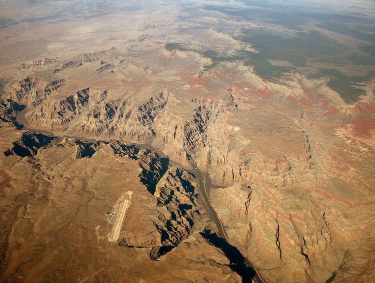
Nice views approach land at grand canyon west airport az
Grand Canyon West Airport (IATA: GCW, FAA LID: 1G4) is a public airport 60 miles (97 km) northwest of Peach Springs, in Mohave County, Arizona. It is owned and operated by the Hualapai tribe and is on the Hualapai Indian Reservation.
Contents
Federal Aviation Administration records say the airport had 71,316 commercial passenger boardings (enplanements) in calendar year 2011 and 147,794 in 2012. The FAA's National Plan of Integrated Airport Systems for 2007–2011 classified it as commercial service - primary because it has over 10,000 passenger boardings per year.
Passengers can fly from Las Vegas or drive (120 miles from Las Vegas) which includes newly paved road that was previously a rough stretch of dirt road.
Plane, helicopter and bus tours are offered. The bus tours stop at Hualapai Ranch, Eagle Point and Guano Point. Eagle Point is home to the Grand Canyon Skywalk.
Facilities
Grand Canyon West Airport covers 350 acres (140 ha); its runway, (17/35), is 5,058 by 60 feet (1,542 m × 18 m) asphalt.
In the year ending June 30, 2006 the airport had 77,502 aircraft operations, average 212 per day: 63% air taxi, 37% airline and <1% general aviation.