
Counties: Washington | Length 30.1 km | |
 | ||
County | ||
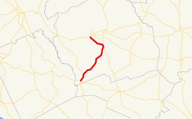
State Route 68 (SR 68) is an 18.7-mile-long (30.1 km) state highway that runs south-to-north through portions of Washington County in the east-central part of the U.S. state of Georgia.
Contents
Map of GA-68, Tennille, GA 31089, USA
Route description
The route begins at an intersection with SR 57 southeast of Oconee. It heads northeast to an intersection with SR 272. Then, it continues northeast until it enters Tenille. There, SR 15 has a short concurrency with SR 68. At the northern end of the concurrency, SR 68 turns northwest until it meets its northern terminus, an intersection with SR 24 and SR 24 Spur, just west of Sandersville.
Major intersections
The entire route is in Washington County.
References
Georgia State Route 68 Wikipedia(Text) CC BY-SA