
Length 26.4 km | ||
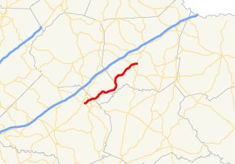 | ||
State Route 326 (SR 326) is a 16.4-mile-long (26.4 km) southwest-to-northeast state highway located mostly in rural areas of the northeastern part of the U.S. state of Georgia. Its route travels within portions of Jackson, Banks, and Franklin counties.
Contents
Map of GA-326, Georgia, USA
Route description
SR 326 begins at an intersection with US 441 Bus./SR 98 (Broad Street) in downtown Commerce, in Jackson County. At this point, it is known as Central Avenue, which continues past the western terminus of the state highway. SR 326 travels northeast for one block and intersects State Street. It turns right onto State Street and passes the Commerce Civic Center, before curving back to the northeast. The highway intersects US 441/SR 15 (Veterans Memorial Parkway) shortly before leaving the city limits of Commerce. At this intersection, the highway becomes known as Old Carnesville Road. During a brief eastward bend, it enters Banks County. Then, it curves again to the northeast. At an intersection with the southeastern terminus of Brown Bridge Road and the southwestern terminus of Duncan Road, SR 326 turns to the right, continuing to follow Old Carnesville Road. It curves to the east-northeast and then to the north-northeast and intersects the southeastern terminus of the aforementioned Duncan Road just before beginning to travel along the Banks–Franklin county line. At the county line, the "Old Carnesville Road" name ends. It curves to the north-northwest and crosses over the Hudson River, where the highway enters Franklin County proper. The highway makes a very gradual curve to the northeast and curve to the north, where it intersects the eastern terminus of Bold Springs Road (which used to be part of SR 164) and the southern terminus of Bold Springs Church Road. At this intersection, SR 326 turns right onto Bold Springs Road for just over 2,000 feet (610 m). There, it diverges from that road and curve to the northeast and crosses over Carlan and Nails Creeks. After bending to the east-northeast, it intersects SR 51 (Sandy Cross Road). Just over 4,000 feet (1,200 m) later, it meets its eastern terminus, an intersection with SR 106 (Athens Road) south-southwest of Carnesville.
SR 326 is not part of the National Highway System, a system of roadways important to the nation's economy, defense, and mobility.